alb2158709
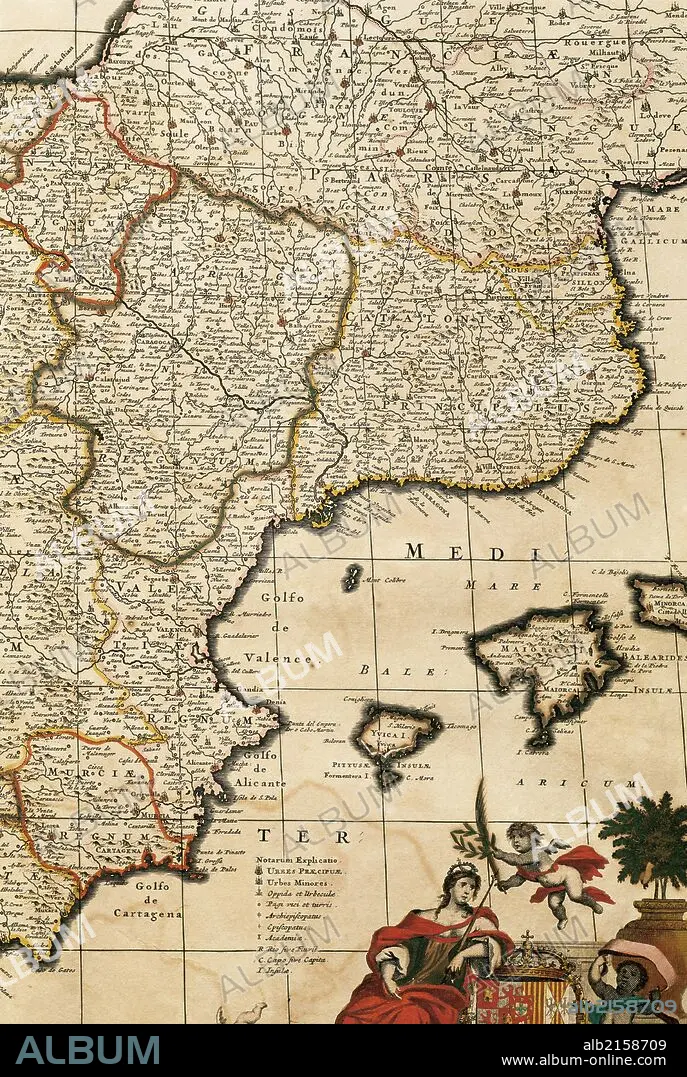
Map of the Principality of Catalonia, Kingdoms of Navarre, Aragon, Valencia, Murcia and the Balearic Islands. Atlas by Frederik de Wit (1630-1706). Amsterdam, 17th century.
| Teilen |
|---|
 Pinterest Pinterest |
 Twitter Twitter |
 Facebook Facebook |
 Link kopieren Link kopieren |
 Email Email |
|
Zu einem anderen Lightbox hinzufügen |
|
Zu einem anderen Lightbox hinzufügen |


Haben Sie bereits ein Konto? Anmelden
Sie haben kein Konto? Registrieren
Dieses Bild kaufen.
Nutzung auswählen:

Untertitel:
Siehe automatische Übersetzung
Map of the Principality of Catalonia, Kingdoms of Navarre, Aragon, Valencia, Murcia and the Balearic Islands. Atlas by Frederik de Wit (1630-1706). Amsterdam, 17th century.
Bildnachweis:
Album / Prisma
Freigaben (Releases):
Bildgröße:
3625 x 5400 px | 56.0 MB
Druckgröße:
30.7 x 45.7 cm | 12.1 x 18.0 in (300 dpi)
Schlüsselwörter:
17. JAHRHUNDERT • 17. JH. • AMSTERDAM • AUSSCHNITT • DETAIL • EUROPA • EUROPAEER (F M) • EUROPAEER • EUROPÄER (F M) • EUROPÄER • EUROPÄISCH • GESCHICHTE • GESCHICHTE, NIEDERLANDE • GESCHICHTE, SPANIEN • HAARLEM, NIEDERLANDE • HOLLAND • INSEL • KARTE (KARTHOGRAFIE) • KARTEN • KARTHOGRAFIE • KARTHOGRAPHIE • KARTOGRAFIE (KARTE) • KARTOGRAPHIE • KATALONIEN • KUESTE • KÖNIGREICH • KÜSTE • LANDKARTE • LANDSCHAFT NIEDERLANDE • MARITIM • MEER • MEERE • MITTELMEER • NIEDERLANDE, LANDSCHAFT • NIEDERLANDE: GESCHICHTE • OZEAN • PLAN (KARTOGRAPHIE) • SEA • SEESTUECK (GEMAELDE) • SPANIEN, GESCHICHTE • WISSENSCH.: KARTOGRAPHIE • ZEITGESCHICHTE
