alb3836471
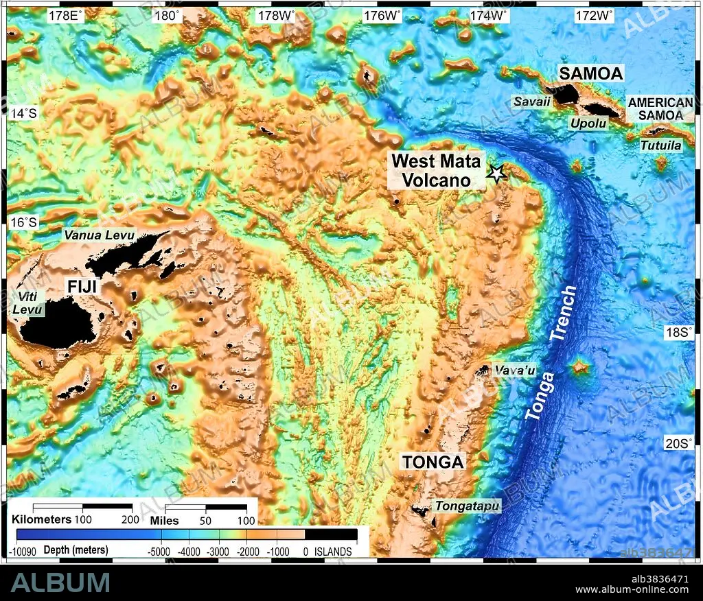
Lau Basin Volcanic Region, Bathymetric Map
| Teilen |
|---|
 Pinterest Pinterest |
 Twitter Twitter |
 Facebook Facebook |
 Link kopieren Link kopieren |
 Email Email |
|
Zu einem anderen Lightbox hinzufügen |
|
Zu einem anderen Lightbox hinzufügen |


Haben Sie bereits ein Konto? Anmelden
Sie haben kein Konto? Registrieren
Dieses Bild kaufen.
Nutzung auswählen:

Titel:
Lau Basin Volcanic Region, Bathymetric Map
Untertitel:
Siehe automatische Übersetzung
The Lau Basin is located in the southwest Pacific, within an area bounded by Samoa, Tonga and Fiji (the black areas on the map, which are the only areas above water). The area is home to many submarine volcanoes, such as West Mata.
Bildnachweis:
Album / NOAA/Science Source
Freigaben (Releases):
Bildgröße:
5512 x 4428 px | 69.8 MB
Druckgröße:
46.7 x 37.5 cm | 18.4 x 14.8 in (300 dpi)
Schlüsselwörter:
AKTIV • MEER • MEERE • OZEAN • PAZIFIK • PAZIFISCHR OZEAN • SEA • SEESTUECK (GEMAELDE) • TOPOGRAPHIE • VULKAN
