alb9617258
WENCESLAUS HOLLAR. Map of the British Isles and illustrations of 17th century historical events, c1659. Artist: Wenceslaus Hollar.
| Teilen |
|---|
 Pinterest Pinterest |
 Twitter Twitter |
 Facebook Facebook |
 Link kopieren Link kopieren |
 Email Email |
|
Zu einem anderen Lightbox hinzufügen |
|
Zu einem anderen Lightbox hinzufügen |


Haben Sie bereits ein Konto? Anmelden
Sie haben kein Konto? Registrieren
Dieses Bild kaufen.
Nutzung auswählen:

Autor:
Titel:
Map of the British Isles and illustrations of 17th century historical events, c1659. Artist: Wenceslaus Hollar.
Untertitel:
Siehe automatische Übersetzung
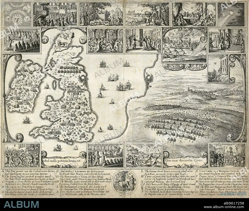
Map of the British Isles and illustrations of 17th century historical events, c1659. The large scene depicts the Battle of the White Mountain in Bohemia in 1620 in the the early stages of the Thirty Years War. The smaller compare the events of the English and Bohemian civil wars. From the Mayson Beeton Collection.
Persönlichkeiten:
Technik/Material:
engraving
Bildnachweis:
Album / Historic England Archive/Heritage Images
Freigaben (Releases):
Model: Nein - Eigentum: Nein
Rechtefragen?
Rechtefragen?
Bildgröße:
4686 x 3731 px | 50.0 MB
Druckgröße:
39.7 x 31.6 cm | 15.6 x 12.4 in (300 dpi)
Schlüsselwörter:
ARMEE • ARMY • FEUER, KRIEG • HEER • HOLLAR • KRIEG • MONOCHROM • MONOCHROMIE • SCHWARZ UND WEISS • SCHWARZ-WEIß • SCHWARZWEISS • SOLDATEN • TSCHECHIEN • TSCHECHISCHE REPUBLIK • WENCESLAUS HOLLAR
