alb1748440
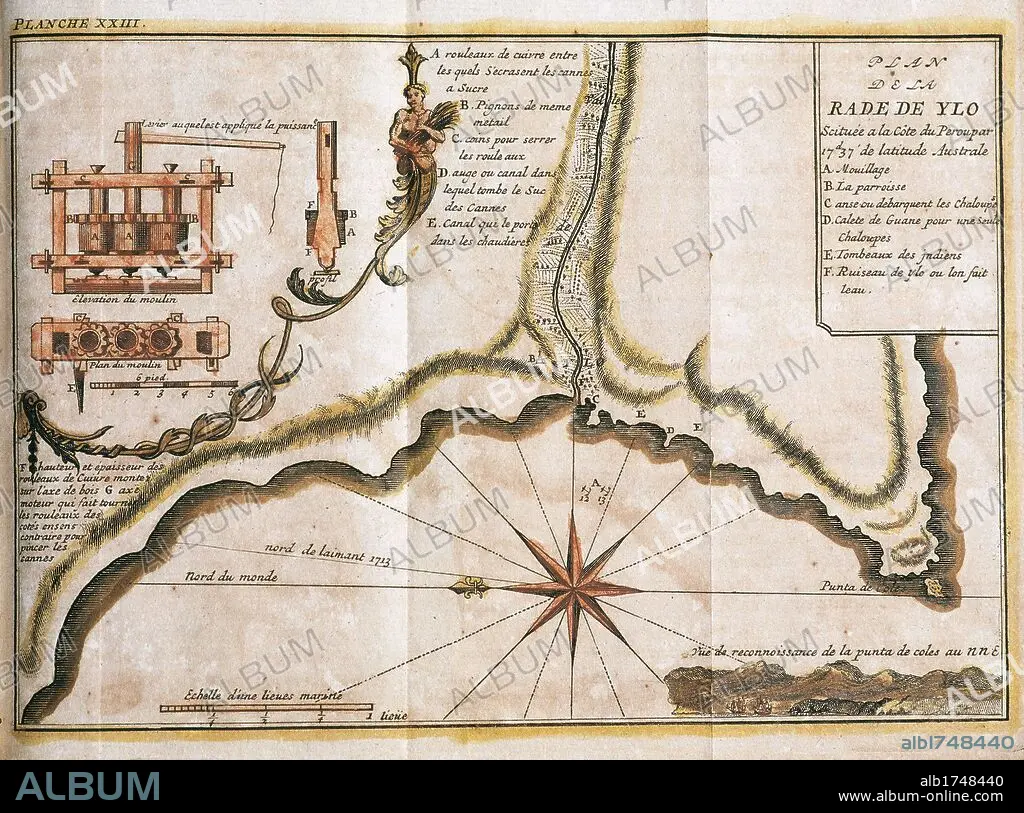
PERU. 18TH CENTURY. MAP OF THE RADA DE YLO (currently ILO), main port located on the Peruvian coast.
 Pinterest
 Twitter
 Facebook
 Link kopieren
 Email
Email


Haben Sie bereits ein Konto? Anmelden
Sie haben kein Konto? Registrieren
Dieses Bild kaufen

Titel:
PERU. 18TH CENTURY. MAP OF THE RADA DE YLO (currently ILO), main port located on the Peruvian coast.
Untertitel:
Siehe automatische Übersetzung
SOUTH AMERICA. PERU. 18TH CENTURY. MAP OF THE RADA DE YLO (currently ILO), main port located on the Peruvian coast. Plane of a sugar mill. "RADA DE YLO", at 17.37 southern latitude, on the Pacific coast. French engraving of 1716. Library of Catalonia. Barcelona.
Bildnachweis:
Album / Kurwenal / Prisma
Freigaben (Releases):
Model: Nein - Eigentum: Nein
Rechtefragen?
Rechtefragen?
Bildgröße:
6201 x 4603 px | 81.7 MB
Druckgröße:
52.5 x 39.0 cm | 20.7 x 15.3 in (300 dpi)
Schlüsselwörter:
18. JAHRHUNDERT • 18. JH. • BOCKWINDMUEHLE • BOCKWINDMÜHLE • KARTE (KARTHOGRAFIE) • KARTEN • KARTHOGRAFIE • KARTHOGRAPHIE • KARTOGRAFIE (KARTE) • KARTOGRAPHIE • KUESTE • KÜSTE • LANDKARTE • LATEINAMERIKANISCH • MARITIM • MUEHLE: WINDMUEHLE • PAZIFIK • PAZIFISCHR OZEAN • PLAN (KARTOGRAPHIE) • REEDE • SCHILFROHR • SÜDAMERIKA • WINDMUEHLE • WINDMÜHLE • WINDRAD • WISSENSCH.: KARTOGRAPHIE • ZUCKERROHR
