alb15427722
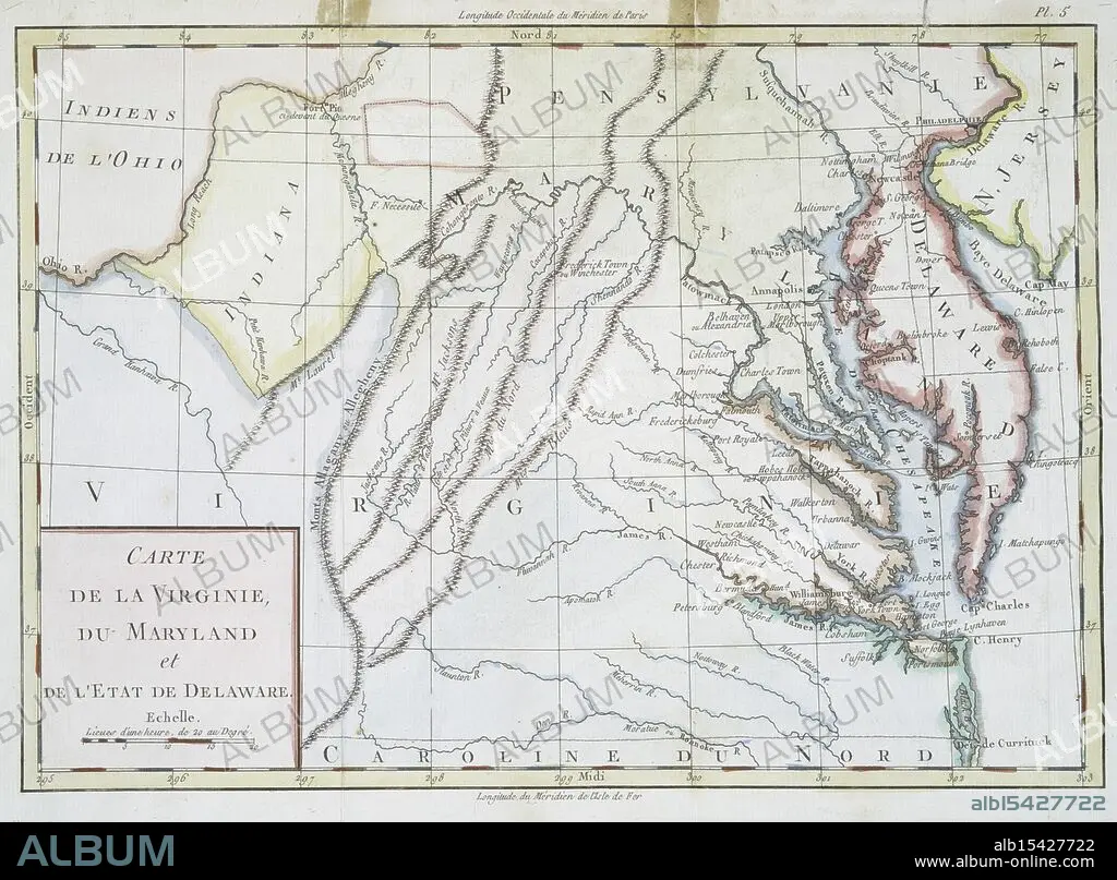
Carte de la Virginie, du Maryland et de l'etat de Delaware., 1782, Date Issued: 1782, (Questionable), Place: Bruxelles :, Publisher: s.n., Delaware, Maps, Early works to 1800, Maryland, Maps, Early works to 1800, Virginia, Maps, Early works to 1800, Extent: 1 map: hand col., 22 x 32 cm., Ancient lands laid bare, Terra firma, ink and pride, History's sweet soil.
| Teilen |
|---|
 Pinterest Pinterest |
 Twitter Twitter |
 Facebook Facebook |
 Link kopieren Link kopieren |
 Email Email |
|
Zu einem anderen Lightbox hinzufügen |
|
Zu einem anderen Lightbox hinzufügen |


Haben Sie bereits ein Konto? Anmelden
Sie haben kein Konto? Registrieren
Dieses Bild kaufen.
Nutzung auswählen:

Untertitel:
Siehe automatische Übersetzung
Carte de la Virginie, du Maryland et de l'etat de Delaware., 1782, Date Issued: 1782, (Questionable), Place: Bruxelles :, Publisher: s.n., Delaware, Maps, Early works to 1800, Maryland, Maps, Early works to 1800, Virginia, Maps, Early works to 1800, Extent: 1 map: hand col., 22 x 32 cm., Ancient lands laid bare, Terra firma, ink and pride, History's sweet soil.
Bildnachweis:
Album / quintlox
Freigaben (Releases):
Bildgröße:
4140 x 3049 px | 36.1 MB
Druckgröße:
35.1 x 25.8 cm | 13.8 x 10.2 in (300 dpi)
Schlüsselwörter:
