alb3926950
Map of Antietam, Sharpsburg and Vicinity, Maryland, 1862 (1862-1867). Artist: Rae Smith
| Teilen |
|---|
 Pinterest Pinterest |
 Twitter Twitter |
 Facebook Facebook |
 Link kopieren Link kopieren |
 Email Email |
|
Zu einem anderen Lightbox hinzufügen |
|
Zu einem anderen Lightbox hinzufügen |


Haben Sie bereits ein Konto? Anmelden
Sie haben kein Konto? Registrieren
Dieses Bild kaufen.
Nutzung auswählen:

Titel:
Map of Antietam, Sharpsburg and Vicinity, Maryland, 1862 (1862-1867). Artist: Rae Smith
Untertitel:
Siehe automatische Übersetzung
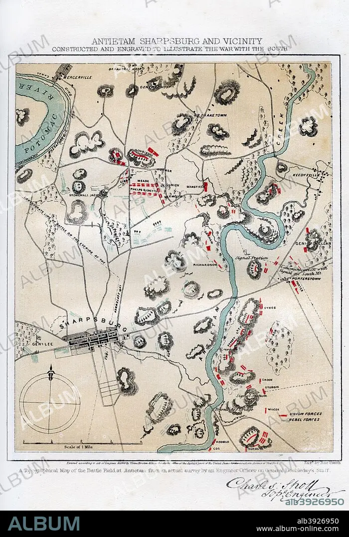
Map of Antietam, Sharpsburg and Vicinity, Maryland, 1862 (1862-1867) The Battle of Antietam, fought on 17 September 1862, was the first battle of the American Civil War to be fought on Union (northern) soil. It was the bloodiest single day battle in American history, with nearly 23,000 casualties. An engraving from volume II of The War with the South : a History of the Late Rebellion, by Robert Tomes, Benjamin G Smith, New York, Virtue & Yorston, 3 Volumes, 1862-1867.
Bildnachweis:
Album / The Print Collector / Heritage Images
Freigaben (Releases):
Bildgröße:
3451 x 5050 px | 49.9 MB
Druckgröße:
29.2 x 42.8 cm | 11.5 x 16.8 in (300 dpi)
Schlüsselwörter:
AMERIKANER • ARMEE • ARMY • FARBE • FARBIG • FEUER, KRIEG • HEER • KARTHOGRAFIE • KARTOGRAFIE (KARTE) • KARTOGRAPHIE • KRIEG • STRATEGIE • WISSENSCH.: KARTOGRAPHIE
