alb3980258
Map of London, 1560. Artist: George Vertue
| Teilen |
|---|
 Pinterest Pinterest |
 Twitter Twitter |
 Facebook Facebook |
 Link kopieren Link kopieren |
 Email Email |
|
Zu einem anderen Lightbox hinzufügen |
|
Zu einem anderen Lightbox hinzufügen |


Haben Sie bereits ein Konto? Anmelden
Sie haben kein Konto? Registrieren
Dieses Bild kaufen.
Nutzung auswählen:

Titel: Map of London, 1560. Artist: George Vertue
Untertitel: Siehe automatische Übersetzung
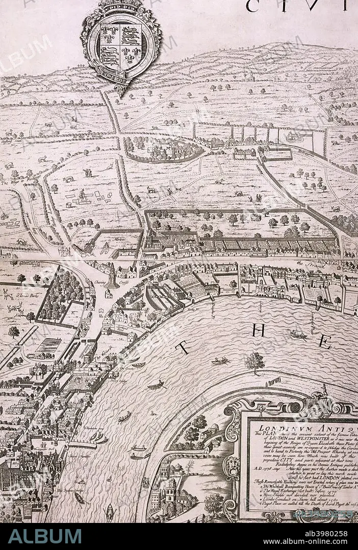
Map of London in the year 1560; showing the area between Westminster and the Strand, with Lambeth to the south of the River Thames and the Tudor royal arms at the top.
Map of London in the year 1560; showing the area between Westminster and the Strand, with Lambeth to the south of the River Thames and the Tudor royal arms at the top.
Persönlichkeiten: GEORGE VERTUE
Bildnachweis: Album / The London Archives (City of London)/Heritage Images
Freigaben (Releases): ? Modellfreigabe: Nein - ? Eigentumsfreigabe: Nein
Rechtefragen?
Rechtefragen?
Bildgröße: 3461 × 5047 px | 50.0 MB
Druckgröße: 29.3 × 42.7 cm | 1362.6 × 1987.0 in (300 dpi)
Schlüsselwörter: 16. JAHRHUNDERT • 16. JH. • ENGLAND • FLUSS THEMSE • GEOGRAFIE • GEOGRAPHIE • GEORGE VERTUE • MONOCHROM • MONOCHROMIE • SCHWARZ UND WEISS • SCHWARZ-WEISS • SCHWARZWEISS • THEMSE, FLUSS • TUDOR
