alb5409490
Tabula Peutingeriana, Roman Empire Road Map
| Teilen |
|---|
 Pinterest Pinterest |
 Twitter Twitter |
 Facebook Facebook |
 Link kopieren Link kopieren |
 Email Email |
|
Zu einem anderen Lightbox hinzufügen |
|
Zu einem anderen Lightbox hinzufügen |


Haben Sie bereits ein Konto? Anmelden
Sie haben kein Konto? Registrieren
Dieses Bild kaufen

Titel:
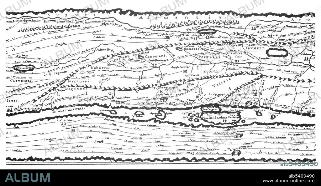
Tabula Peutingeriana, Roman Empire Road Map
Untertitel:
Siehe automatische Übersetzung
Detail of the Tabula Peutingeriana, an illustrated itinerarium (road map) showing the cursus publicus, the road network in the Roman Empire. The original map upon which it is based probably dates to the 4th or 5th century and was itself based on a map prepared by Agrippa during the reign of the emperor Augustus (27 BC - 14 AD).
Bildnachweis:
Album / Science Source
Freigaben (Releases):
Model: Nein - Eigentum: Nein
Rechtefragen?
Rechtefragen?
Bildgröße:
5175 x 2737 px | 40.5 MB
Druckgröße:
43.8 x 23.2 cm | 17.2 x 9.1 in (300 dpi)
Schlüsselwörter:
