alb4504331
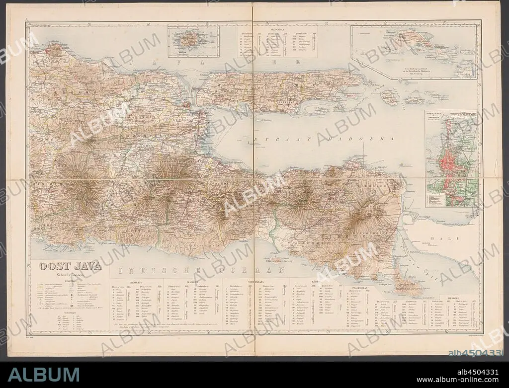
Map of East Java, Map of East Java with legend and inset maps from the area around Surabaya, the Kangean Islands and the island of Bawean. Numbered top left: 5. With degree distribution along the edges, maps of separate countries or regions, East Java, Bawean, Kangean Islands, Surabaya, Topografische Inrichting (mentioned on object), Java, 1906, paper, linen (material), h 655 mm × w 920 mm.
| Teilen |
|---|
 Pinterest Pinterest |
 Twitter Twitter |
 Facebook Facebook |
 Link kopieren Link kopieren |
 Email Email |
|
Zu einem anderen Lightbox hinzufügen |
|
Zu einem anderen Lightbox hinzufügen |


Haben Sie bereits ein Konto? Anmelden
Sie haben kein Konto? Registrieren
Dieses Bild kaufen.
Nutzung auswählen:

Untertitel: Siehe automatische Übersetzung
Map of East Java, Map of East Java with legend and inset maps from the area around Surabaya, the Kangean Islands and the island of Bawean. Numbered top left: 5. With degree distribution along the edges, maps of separate countries or regions, East Java, Bawean, Kangean Islands, Surabaya, Topografische Inrichting (mentioned on object), Java, 1906, paper, linen (material), h 655 mm × w 920 mm
Map of East Java, Map of East Java with legend and inset maps from the area around Surabaya, the Kangean Islands and the island of Bawean. Numbered top left: 5. With degree distribution along the edges, maps of separate countries or regions, East Java, Bawean, Kangean Islands, Surabaya, Topografische Inrichting (mentioned on object), Java, 1906, paper, linen (material), h 655 mm × w 920 mm
Bildnachweis: Album / quintlox
Freigaben (Releases): ? Modellfreigabe: Nein - ? Eigentumsfreigabe: Nein
Rechtefragen?
Rechtefragen?
Bildgröße: 6000 × 4265 px | 73.2 MB
Druckgröße: 50.8 × 36.1 cm | 2362.2 × 1679.1 in (300 dpi)
Schlüsselwörter: INSEL • KARTE (KARTHOGRAFIE) • KARTEN • KARTHOGRAPHIE • LANDKARTE • MATERIAL • OBJEKT • PAPIER • PLAN (KARTOGRAPHIE) • REGIONEN
