alb3545996
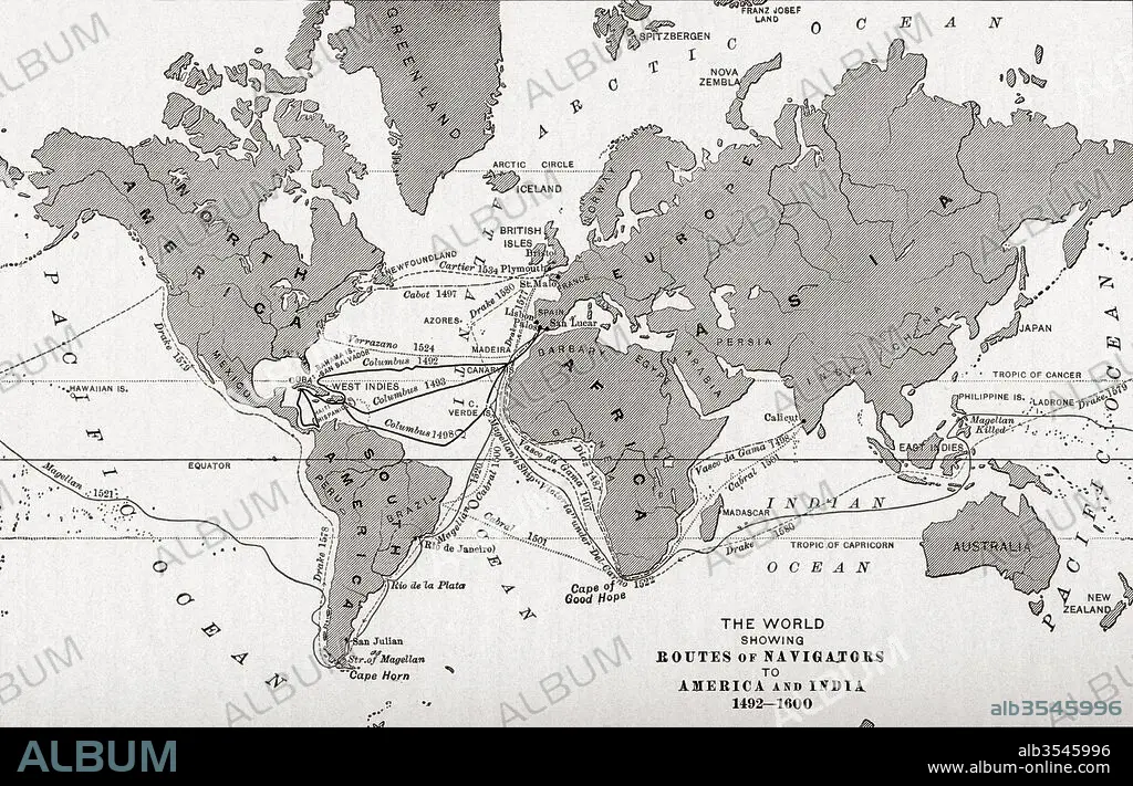
Map of the world showing the routes of navigators to America and India from 1492-1600
| Teilen |
|---|
 Pinterest Pinterest |
 Twitter Twitter |
 Facebook Facebook |
 Link kopieren Link kopieren |
 Email Email |
|
Zu einem anderen Lightbox hinzufügen |
|
Zu einem anderen Lightbox hinzufügen |


Haben Sie bereits ein Konto? Anmelden
Sie haben kein Konto? Registrieren
Dieses Bild kaufen.
Nutzung auswählen:

Titel:
Map of the world showing the routes of navigators to America and India from 1492-1600
Untertitel:
Siehe automatische Übersetzung
Map of the world showing the routes of navigators to America and India from 1492-1600. From The History of Our Country, published 1899
Bildnachweis:
Album / Universal Images Group / Universal History Archive
Freigaben (Releases):
Bildgröße:
5220 x 3355 px | 50.1 MB
Druckgröße:
44.2 x 28.4 cm | 17.4 x 11.2 in (300 dpi)
Schlüsselwörter:
15. JAHRHUNDERT • 15. JH. • 16. JAHRHUNDERT • 16. JH. • AMERIKA • AMERIKA, KONTINENT • AMERIKANERIN • AMERIKANISCH (US) • AMERIKANISCH • ENTDECKUNG • ERKUNDUNG • GEOGRAFIE • GEOGRAPHIE • KARTE (KARTHOGRAFIE) • KARTE • KARTEN • KARTHOGRAPHIE • KONTINENT: AMERIKA • LAENDER • LANDKARTE • LÄNDER • NAVIGATION • PLAN (KARTOGRAPHIE) • US-AMERIKANISCH • USA • USA-VEREINIGE STAATEN • WELT
