alb3988176
Map of Aldgate Ward, City of London, 1739. Artist: RW Seale
| Teilen |
|---|
 Pinterest Pinterest |
 Twitter Twitter |
 Facebook Facebook |
 Link kopieren Link kopieren |
 Email Email |
|
Zu einem anderen Lightbox hinzufügen |
|
Zu einem anderen Lightbox hinzufügen |


Haben Sie bereits ein Konto? Anmelden
Sie haben kein Konto? Registrieren
Dieses Bild kaufen.
Nutzung auswählen:

Titel: Map of Aldgate Ward, City of London, 1739. Artist: RW Seale
Untertitel: Siehe automatische Übersetzung
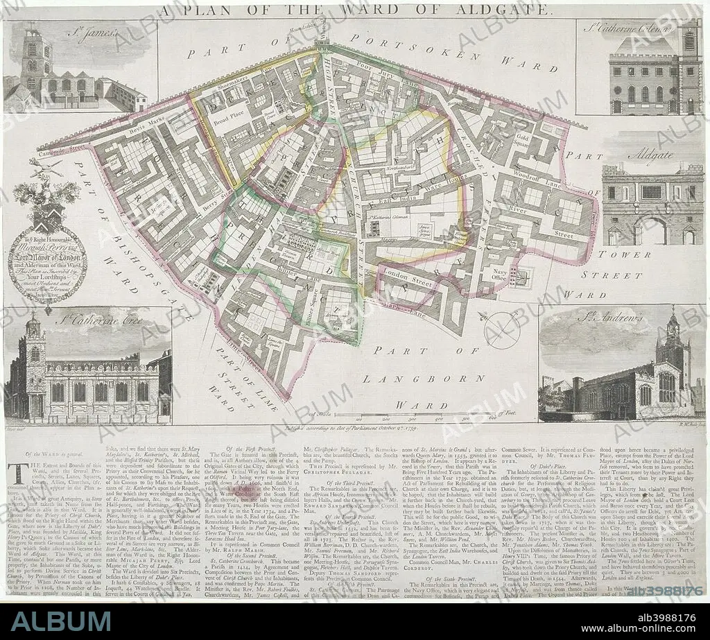
Map of Aldgate Ward, City of London, 1739. With images in the margins of Aldgate and four ward churches: St James, Duke Street, St Katherine Cree, St Katherine Coleman and St Andrew Undershaft. Below is a description of the ward.
Map of Aldgate Ward, City of London, 1739. With images in the margins of Aldgate and four ward churches: St James, Duke Street, St Katherine Cree, St Katherine Coleman and St Andrew Undershaft. Below is a description of the ward.
Persönlichkeiten: JACOB
Bildnachweis: Album / The London Archives (City of London)/Heritage Images
Freigaben (Releases): ? Modellfreigabe: Nein - ? Eigentumsfreigabe: Nein
Rechtefragen?
Rechtefragen?
Bildgröße: 2718 × 2310 px | 18.0 MB
Druckgröße: 23.0 × 19.6 cm | 1070.1 × 909.4 in (300 dpi)
Schlüsselwörter: 18. JAHRHUNDERT • 18. JH. • AUSSENAUFNAHME • CHRISTENTUM • ECCLESIA • ENGLAND • FARBE • FARBIG • INNENRAEUME: KIRCHEN • JACOB • KIRCHE • KIRCHEN • RELIGION
