alb1962068
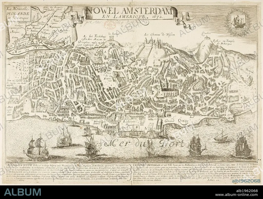
Map of New Amsterdam (New York) in 1672 and then in 1729, showing 88 years of growth. . Nowel Amsterdam 1729. New York, USA. Actual Map and Comparative Plans showing 88 years growth of the City of New York, by D. Longworth. (Plan of New York in 1729, surveyed by I. Lyne). Publisher/year :New York, 1817. Source: Maps.73953 (3).
| Teilen |
|---|
 Pinterest Pinterest |
 Twitter Twitter |
 Facebook Facebook |
 Link kopieren Link kopieren |
 Email Email |
|
Zu einem anderen Lightbox hinzufügen |
|
Zu einem anderen Lightbox hinzufügen |


Haben Sie bereits ein Konto? Anmelden
Sie haben kein Konto? Registrieren
Dieses Bild kaufen.
Nutzung auswählen:

Untertitel:
Siehe automatische Übersetzung
Map of New Amsterdam (New York) in 1672 and then in 1729, showing 88 years of growth. . Nowel Amsterdam 1729. New York, USA. Actual Map and Comparative Plans showing 88 years growth of the City of New York, by D. Longworth. (Plan of New York in 1729, surveyed by I. Lyne). Publisher/year :New York, 1817. Source: Maps.73953 (3).
Bildnachweis:
Album / British Library
Freigaben (Releases):
Bildgröße:
7144 x 5038 px | 103.0 MB
Druckgröße:
60.5 x 42.7 cm | 23.8 x 16.8 in (300 dpi)
Schlüsselwörter:
