alb9831162
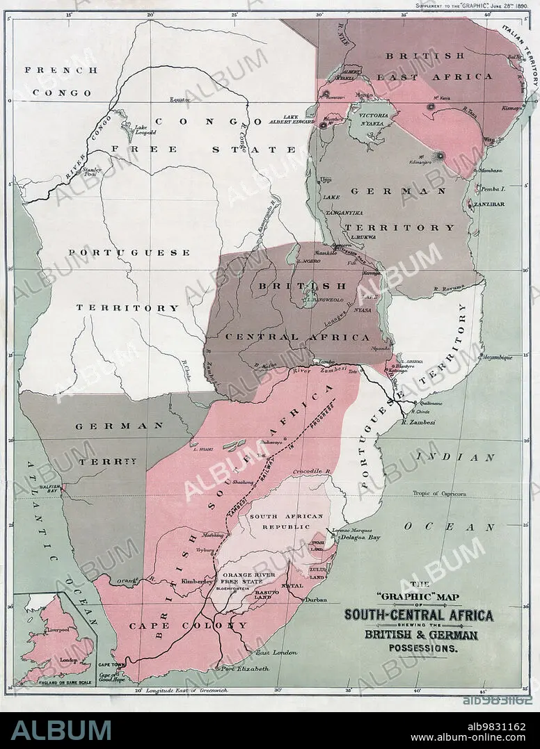
Map of south-Central Africa showing British and German possessions in the 1890s. After a map published in the June 25th, 1890 edition of The Graphic. The inset map, lower left, shows England on the same scale as the African map.
| Teilen |
|---|
 Pinterest Pinterest |
 Twitter Twitter |
 Facebook Facebook |
 Link kopieren Link kopieren |
 Email Email |
|
Zu einem anderen Lightbox hinzufügen |
|
Zu einem anderen Lightbox hinzufügen |


Haben Sie bereits ein Konto? Anmelden
Sie haben kein Konto? Registrieren
Dieses Bild kaufen.
Nutzung auswählen:

Untertitel: Siehe automatische Übersetzung
Map of south-Central Africa showing British and German possessions in the 1890s. After a map published in the June 25th, 1890 edition of The Graphic. The inset map, lower left, shows England on the same scale as the African map.
Map of south-Central Africa showing British and German possessions in the 1890s. After a map published in the June 25th, 1890 edition of The Graphic. The inset map, lower left, shows England on the same scale as the African map.
Bildnachweis: Album / Ken Welsh/Universal History Archive/Universal Images Group
Freigaben (Releases): ? Modellfreigabe: Nein - ? Eigentumsfreigabe: Nein
Rechtefragen?
Rechtefragen?
Bildgröße: 4029 × 5315 px | 61.3 MB
Druckgröße: 34.1 × 45.0 cm | 1586.2 × 2092.5 in (300 dpi)
Schlüsselwörter: AFRIKA • ARCHIV • BESITZ • BLACK • BRITISCHE • DEUTSCH • DEUTSCHLAND • ENGLAND • ENGLISCH • GEOGRAFIE • GEOGRAPHIE • GESCHICHTE • GROSSBRITANNIEN • ILLUSTRATION • ILLUSTRATIONS • KARTHOGRAFIE • KARTOGRAFIE (KARTE) • KARTOGRAPHIE • KOLONIALISMUS • KOLONIE • SCHWARZ • WEISS (FARBE) • WEISS • WISSENSCH.: KARTOGRAPHIE • ZEITGESCHICHTE
