alb9226744
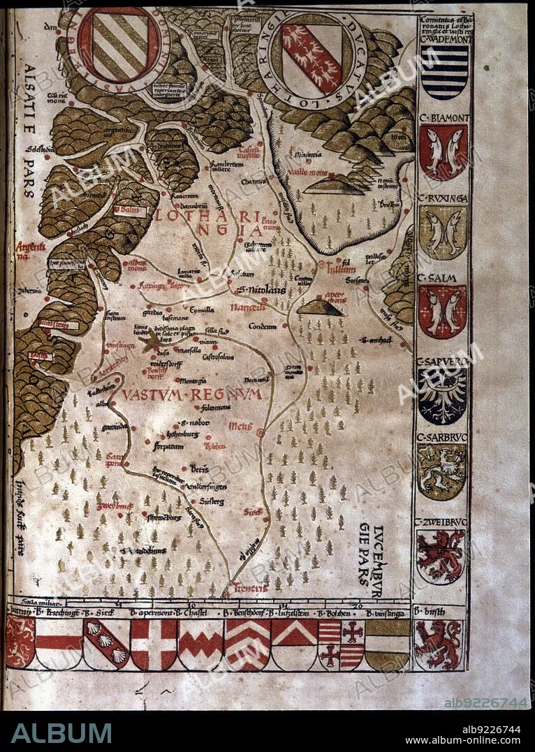
Map of the Duchy of Lotaringia, now Lorraine (France), 1596. Creator: Ptolomeo, Claudio. (90-168).
| Teilen |
|---|
 Pinterest Pinterest |
 Twitter Twitter |
 Facebook Facebook |
 Link kopieren Link kopieren |
 Email Email |
|
Zu einem anderen Lightbox hinzufügen |
|
Zu einem anderen Lightbox hinzufügen |


Haben Sie bereits ein Konto? Anmelden
Sie haben kein Konto? Registrieren
Dieses Bild kaufen.
Nutzung auswählen:

Titel:
Map of the Duchy of Lotaringia, now Lorraine (France), 1596. Creator: Ptolomeo, Claudio. (90-168).
Untertitel:
Siehe automatische Übersetzung
Map of the Duchy of Lotaringia, now Lorraine (France). In'Geographiae Universae', 1596.
Bildnachweis:
Album / Index/Heritage Images
Freigaben (Releases):
Bildgröße:
4865 x 6507 px | 90.6 MB
Druckgröße:
41.2 x 55.1 cm | 16.2 x 21.7 in (300 dpi)
Schlüsselwörter:
