alb3816425
Map of the Old World
| Teilen |
|---|
 Pinterest Pinterest |
 Twitter Twitter |
 Facebook Facebook |
 Link kopieren Link kopieren |
 Email Email |
|
Zu einem anderen Lightbox hinzufügen |
|
Zu einem anderen Lightbox hinzufügen |


Haben Sie bereits ein Konto? Anmelden
Sie haben kein Konto? Registrieren
Dieses Bild kaufen.
Nutzung auswählen:

Titel: Map of the Old World
Untertitel: Siehe automatische Übersetzung
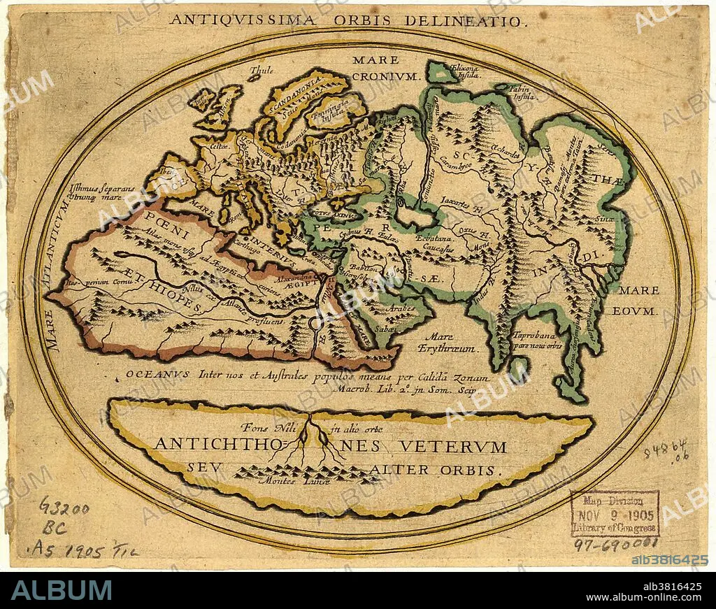
Map of the Old World with Latin text. The title is Antiquissima Orbis Delineatio (ancient world map). The level of geographical knowledge is similar to that until the 15th century. The map shows: Europe (yellow), North Africa (red), West-Central Asia (green) and a southern area (yellow, Antichthones: antipodes). Named regions include: Mare Interius (middle sea: Mediterranean), Mare Eoum (eastern sea), Scythae (Scythia: Central Asia), Persae (Persia) and Indi (India). Forests, mountains and rivers are shown. The equator is an ocean of warm water. The Nile has a western and southern branch; the latter from the Mountains of the Moon (Montes Lunae). Catalogued: US Library of Congress (1905).
Map of the Old World with Latin text. The title is Antiquissima Orbis Delineatio (ancient world map). The level of geographical knowledge is similar to that until the 15th century. The map shows: Europe (yellow), North Africa (red), West-Central Asia (green) and a southern area (yellow, Antichthones: antipodes). Named regions include: Mare Interius (middle sea: Mediterranean), Mare Eoum (eastern sea), Scythae (Scythia: Central Asia), Persae (Persia) and Indi (India). Forests, mountains and rivers are shown. The equator is an ocean of warm water. The Nile has a western and southern branch; the latter from the Mountains of the Moon (Montes Lunae). Catalogued: US Library of Congress (1905).
Bildnachweis: Album / Science Source / LOC/Geography and Map Division
Freigaben (Releases): ? Modellfreigabe: Nein - ? Eigentumsfreigabe: Nein
Rechtefragen?
Rechtefragen?
Bildgröße: 2468 × 1971 px | 13.9 MB
Druckgröße: 20.9 × 16.7 cm | 971.7 × 776.0 in (300 dpi)
Schlüsselwörter: AFRIKA • ASIEN • ASIEN, KONTINENT • DIAGRAMM • GEOGRAFIE • GEOGRAPHIE • ILLUSTRATION • ILLUSTRATIONS • KARTHOGRAFIE • KARTOGRAFIE (KARTE) • KARTOGRAPHIE • KONTINENT, ASIEN • LANDSCHAFT • WELT • WISSENSCH.: KARTOGRAPHIE
