alb4075494
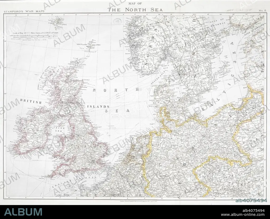
First World War map of the North Sea, 1914. Stanford's War Maps. No. 5. Map of the North Sea. Scale 50,8235 miles - 1 inch, or 1:3,220,177 of nature. London, 12 August 1914. Source: Maps.1035.(90) no.5.
| Teilen |
|---|
 Pinterest Pinterest |
 Twitter Twitter |
 Facebook Facebook |
 Link kopieren Link kopieren |
 Email Email |
|
Zu einem anderen Lightbox hinzufügen |
|
Zu einem anderen Lightbox hinzufügen |


Haben Sie bereits ein Konto? Anmelden
Sie haben kein Konto? Registrieren
Dieses Bild kaufen

Untertitel:
Siehe automatische Übersetzung
First World War map of the North Sea, 1914. Stanford's War Maps. No. 5. Map of the North Sea. Scale 50,8235 miles - 1 inch, or 1:3,220,177 of nature. London, 12 August 1914. Source: Maps.1035.(90) no.5.
Bildnachweis:
Album / British Library
Freigaben (Releases):
Model: Nein - Eigentum: Nein
Rechtefragen?
Rechtefragen?
Bildgröße:
7886 x 5993 px | 135.2 MB
Druckgröße:
66.8 x 50.7 cm | 26.3 x 20.0 in (300 dpi)
Schlüsselwörter:
1. WELTKRIEG • EREIGNIS • ERSTER WELTKRIEG • FEUER, KRIEG • FIRST WORLD WAR • KARTE (KARTHOGRAFIE) • KARTE • KARTEN • KARTHOGRAFIE • KARTHOGRAPHIE • KARTOGRAFIE (KARTE) • KARTOGRAPHIE • KRIEG • KRIEG, ERSTER WELTKRIEG • KRIEG, WELTKRIEG I • LANDKARTE • PLAN (KARTOGRAPHIE) • WELTKRIEG I • WISSENSCH.: KARTOGRAPHIE • WORLD WAR 1 • WORLD WAR I • WORLD WAR ONE • WWI
