alb5480343
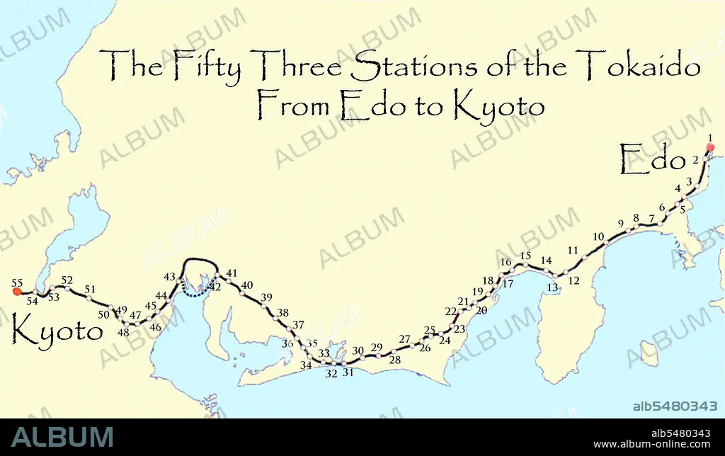
Map of the 'Fifty Three Stations of the Tokaido', or East Sea Highway linking Edo (Tokyo) to Kyoto during the 18th and 19th centuries.
| Teilen |
|---|
 Pinterest Pinterest |
 Twitter Twitter |
 Facebook Facebook |
 Link kopieren Link kopieren |
 Email Email |
|
Zu einem anderen Lightbox hinzufügen |
|
Zu einem anderen Lightbox hinzufügen |


Haben Sie bereits ein Konto? Anmelden
Sie haben kein Konto? Registrieren
Dieses Bild kaufen

Titel:
Map of the 'Fifty Three Stations of the Tokaido', or East Sea Highway linking Edo (Tokyo) to Kyoto during the 18th and 19th centuries.
Untertitel:
Siehe automatische Übersetzung
Map of the 'Fifty Three Stations of the Tokaido' between Edo (Tokyo) and Kyoto. The Ti kaidi (East Sea Road) was the most important of the Five Routes of the Edo period, connecting Edo (modern-day Tokyo) to Kyoto in Japan. Unlike the inland and less heavily travelled Nakasendi, the Ti kaidi travelled along the sea coast of eastern Honshu, hence the route's name.
Bildnachweis:
Album / Pictures From History/Universal Images Group
Freigaben (Releases):
Model: Nein - Eigentum: Nein
Rechtefragen?
Rechtefragen?
Bildgröße:
5500 x 3176 px | 50.0 MB
Druckgröße:
46.6 x 26.9 cm | 18.3 x 10.6 in (300 dpi)
Schlüsselwörter:
ASIEN • ASIEN, KONTINENT • GESCHICHTE • GEWERBE • JAPAN • JAPANER • JAPANERIN • JAPANISCH • KARTE (KARTHOGRAFIE) • KARTE • KARTEN • KARTHOGRAFIE • KARTHOGRAPHIE • KARTOGRAFIE (KARTE) • KARTOGRAPHIE • KONTINENT, ASIEN • LANDKARTE • ORMNAMENT: JAPANISCH • PLAN (KARTOGRAPHIE) • TRANSPORT • TRANSPORTE • WISSENSCH.: KARTOGRAPHIE • ZEITGESCHICHTE
