alb5375052
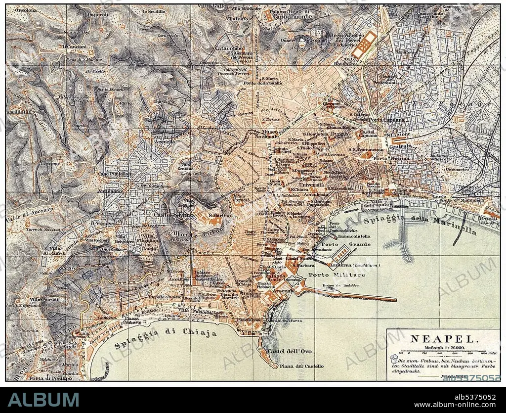
Historical map of Naples and surroundings, Italy, 19th Century, from Meyers Konversations-Lexikon encyclopaedia, 1889, Europe.
| Teilen |
|---|
 Pinterest Pinterest |
 Twitter Twitter |
 Facebook Facebook |
 Link kopieren Link kopieren |
 Email Email |
|
Zu einem anderen Lightbox hinzufügen |
|
Zu einem anderen Lightbox hinzufügen |


Haben Sie bereits ein Konto? Anmelden
Sie haben kein Konto? Registrieren
Dieses Bild kaufen.
Nutzung auswählen:

Untertitel: Siehe automatische Übersetzung
Historical map of Naples and surroundings, Italy, 19th Century, from Meyers Konversations-Lexikon encyclopaedia, 1889, Europe
Historical map of Naples and surroundings, Italy, 19th Century, from Meyers Konversations-Lexikon encyclopaedia, 1889, Europe
Bildnachweis: Album / ImageBroker / H.-D. Falkenstein
Freigaben (Releases): ? Modellfreigabe: Nein - ? Eigentumsfreigabe: Nein
Rechtefragen?
Rechtefragen?
Bildgröße: 4794 × 3659 px | 50.2 MB
Druckgröße: 40.6 × 31.0 cm | 1887.4 × 1440.6 in (300 dpi)
Schlüsselwörter: BILDER • FARBIG • GEOGRAFIE • GEOGRAPHIE • IN GEMAELDEN • INNENRAEUME: IN GEMAELDEN • ITALIEN • KADER • KARTE • KARTEN • MALEN • MEHRFARBIG • NEAPEL • PAPPE • STADTPLAN • ZEICHNUNGEN
