alb1962114
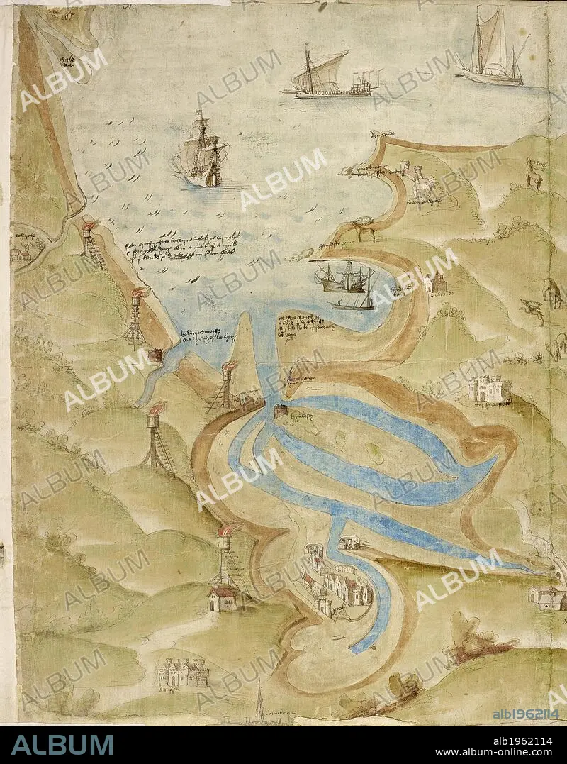
Map of Mount's Bay in Cornwall. Coastline. Sand flats and sheltered estuary and bay. Ships. . A Large colored chart of Mount’s Bay, in Cornwall. Cornwall, drawn c. 1540. A Large colored chart of Mount’s Bay, in Cornwall, drawn c. 1540. . Source: Cotton Augustus I. I 31-33 (detail). Language: English.
| Teilen |
|---|
 Pinterest Pinterest |
 Twitter Twitter |
 Facebook Facebook |
 Link kopieren Link kopieren |
 Email Email |
|
Zu einem anderen Lightbox hinzufügen |
|
Zu einem anderen Lightbox hinzufügen |


Haben Sie bereits ein Konto? Anmelden
Sie haben kein Konto? Registrieren
Dieses Bild kaufen.
Nutzung auswählen:

Untertitel:
Siehe automatische Übersetzung
Map of Mount's Bay in Cornwall. Coastline. Sand flats and sheltered estuary and bay. Ships. . A Large colored chart of Mount’s Bay, in Cornwall. Cornwall, drawn c. 1540. A Large colored chart of Mount’s Bay, in Cornwall, drawn c. 1540. . Source: Cotton Augustus I. I 31-33 (detail). Language: English.
Bildnachweis:
Album / British Library
Freigaben (Releases):
Model: Nein - Eigentum: Nein
Rechtefragen?
Rechtefragen?
Bildgröße:
4866 x 6226 px | 86.7 MB
Druckgröße:
41.2 x 52.7 cm | 16.2 x 20.8 in (300 dpi)
Schlüsselwörter:
BOOTSANLEGESTELLE • BUCHT • ENGLAND • EUROPA • GROSSBRITANNIEN • GROßBRITANNIEN • HAFEN • KARTE (KARTHOGRAFIE) • KARTEN • KARTHOGRAFIE • KARTHOGRAPHIE • KARTOGRAFIE (KARTE) • KARTOGRAPHIE • LANDKARTE • LANDUNGSBRÜCKE • MEERESBUCHT • PLAN (KARTOGRAPHIE) • SCHIFF: HAFEN • TOPOGRAPHIE • WISSENSCH.: KARTOGRAPHIE
