alb3907897
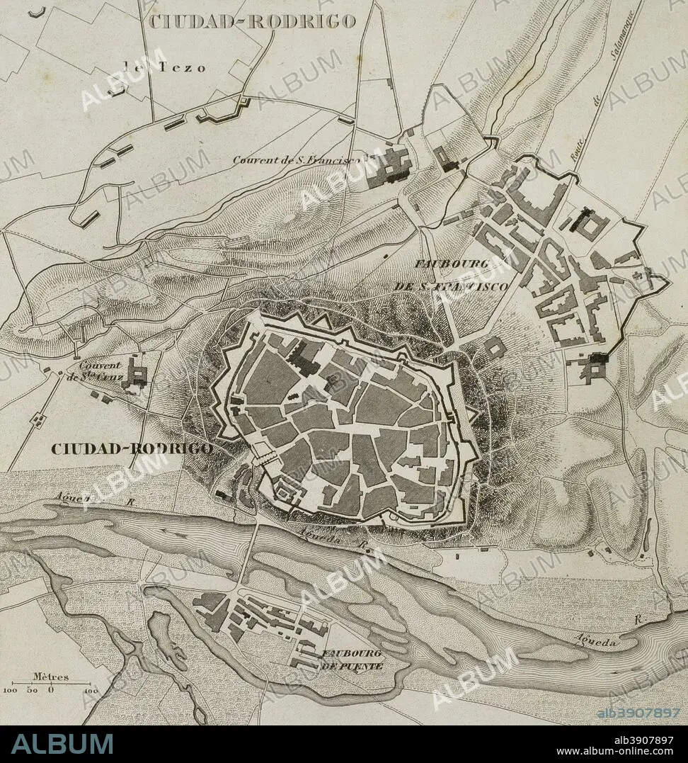
Napoleonic map. Ciudad Rodrigo (province of Salamanca, Castile and Leon, Spain). During the Peninsulan War the city was besieged twice, 1810 and 1812. Atlas de l'Histoire du Consulat et de l'Empire. History of the Consulate and the Empire of France under Napoleon by Marie Joseph Louis Adolphe Thiers (1797-1877). Drawings by Dufour, engravings by Dyonnet. Edited in Paris, 1864.
| Teilen |
|---|
 Pinterest Pinterest |
 Twitter Twitter |
 Facebook Facebook |
 Link kopieren Link kopieren |
 Email Email |
|
Zu einem anderen Lightbox hinzufügen |
|
Zu einem anderen Lightbox hinzufügen |


Haben Sie bereits ein Konto? Anmelden
Sie haben kein Konto? Registrieren
Dieses Bild kaufen.
Nutzung auswählen:

Untertitel: Siehe automatische Übersetzung
Napoleonic map. Ciudad Rodrigo (province of Salamanca, Castile and Leon, Spain). During the Peninsulan War the city was besieged twice, 1810 and 1812. Atlas de l'Histoire du Consulat et de l'Empire. History of the Consulate and the Empire of France under Napoleon by Marie Joseph Louis Adolphe Thiers (1797-1877). Drawings by Dufour, engravings by Dyonnet. Edited in Paris, 1864.
Napoleonic map. Ciudad Rodrigo (province of Salamanca, Castile and Leon, Spain). During the Peninsulan War the city was besieged twice, 1810 and 1812. Atlas de l'Histoire du Consulat et de l'Empire. History of the Consulate and the Empire of France under Napoleon by Marie Joseph Louis Adolphe Thiers (1797-1877). Drawings by Dufour, engravings by Dyonnet. Edited in Paris, 1864.
Persönlichkeiten: NAPOLEON BONAPARTE (1769-1821)
Bildnachweis: Album / Prisma
Freigaben (Releases): ? Modellfreigabe: Nein - ? Eigentumsfreigabe: Nein
Rechtefragen?
Rechtefragen?
Bildgröße: 3543 × 3733 px | 37.8 MB
Druckgröße: 30.0 × 31.6 cm | 1394.9 × 1469.7 in (300 dpi)
Schlüsselwörter: ALT (ALTER) • ALTERTÜMLICH • ANTIK • BELAGERUNG • CIUDAD RODRIGO • EROBERUNG • EUROPA • EUROPAEER (F M) • EUROPAEER • EUROPÄER (F M) • EUROPÄER • EUROPÄISCH • FRANKREICH • GEOGRAFIE • GEOGRAPHIE • GESCHICHTE • GRAVUR • ILLUSTRATION • ILLUSTRATIONS • KARTE (KARTHOGRAFIE) • KARTEN • KARTHOGRAFIE • KARTHOGRAPHIE • KARTOGRAFIE (KARTE) • KARTOGRAPHIE • KRIEG, NAPOLEONISCH • KRIEG: BELAGERUNG • LANDKARTE • NAPOLEON BONAPARTE • NAPOLEONISCHE KRIEGE • NAPOLEONISCHER KRIEG • PLAN (KARTOGRAPHIE) • SIEG (ERFOLG) • SIEG • SPANIEN • STICH (KUNST) • TECHNIK: ZEICHNUNG • TRIUMPH • URBANISMUS • URBANISTIK • VIKTORIA • WISSENSCH.: KARTOGRAPHIE • ZEICHNEN • ZEICHNUNG • ZEITGESCHICHTE
