alb9838905
NICOLAES VISSCHER. Map of North Holland, c.1700-c.1710. Creator: Nicolaes Visscher.
| Teilen |
|---|
 Pinterest Pinterest |
 Twitter Twitter |
 Facebook Facebook |
 Link kopieren Link kopieren |
 Email Email |
|
Zu einem anderen Lightbox hinzufügen |
|
Zu einem anderen Lightbox hinzufügen |


Haben Sie bereits ein Konto? Anmelden
Sie haben kein Konto? Registrieren
Dieses Bild kaufen.
Nutzung auswählen:

Autor:
Titel:
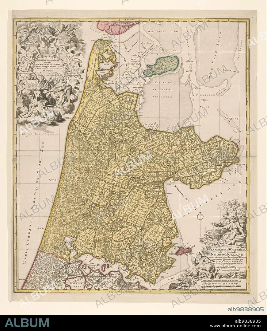
Map of North Holland, c.1700-c.1710. Creator: Nicolaes Visscher.
Untertitel:
Siehe automatische Übersetzung
Map of North Holland, c.1700-c.1710. 'Kennemaria et Westfrisia vulgo et vernaculé Noord-Holland tam in minores quam Praecipuas Ditiones...'. Showing the southern tip of Texel, Wieringen, Marken and a small section of South Holland. At the bottom right scale in German and French miles (1: 150,000). At the bottom right the title, farmers with cheeses, butter and milk. At top left, dedication and putti with the imperial crown and coat of arms, allegorical figures - one holding a windmill looking at an image of a lock.
Persönlichkeiten:
Bildnachweis:
Album / Heritage Art/Heritage Images
Freigaben (Releases):
Bildgröße:
4748 x 5584 px | 75.9 MB
Druckgröße:
40.2 x 47.3 cm | 15.8 x 18.6 in (300 dpi)
Schlüsselwörter:
18. JAHRHUNDERT • 18. JH. • ABDRUCK • CHERUB • FARBE • FARBIG • FUELLHORN • FÜLLHORN • GEOGRAFIE • GEOGRAPHIE • HEILIGES ROEMISCHES REICH • INSEL • KUESTE • KÜSTE • MARITIM • MILCH • MILCHKANNE • NATUR • NICOLAES VISSCHER • PIETER SCHENK • PUTTE • SANDBANK • TIEFBAU
