alb3800434
After Fall of Roman Empire, 5th Century
| Teilen |
|---|
 Pinterest Pinterest |
 Twitter Twitter |
 Facebook Facebook |
 Link kopieren Link kopieren |
 Email Email |
|
Zu einem anderen Lightbox hinzufügen |
|
Zu einem anderen Lightbox hinzufügen |


Haben Sie bereits ein Konto? Anmelden
Sie haben kein Konto? Registrieren
Dieses Bild kaufen.
Nutzung auswählen:

Titel: After Fall of Roman Empire, 5th Century
Untertitel: Siehe automatische Übersetzung
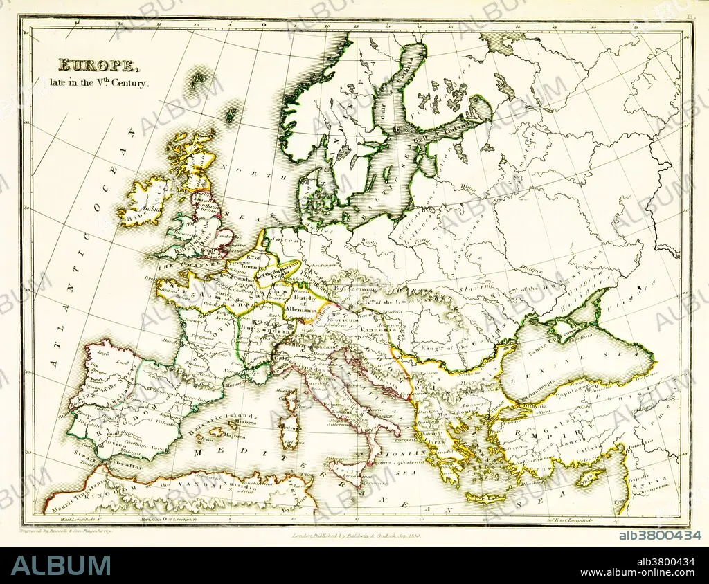
A map of Europe, showing territorial borders existing in the 5th century, after the Western Roman Empire had effectively collapsed. By 476 CE, when Odoacer deposed the Emperor Romulus, the Western Roman Empire wielded negligible military, political, or financial power and had no effective control over the scattered Western domains that could still be described as Roman. Map published in 1831.
A map of Europe, showing territorial borders existing in the 5th century, after the Western Roman Empire had effectively collapsed. By 476 CE, when Odoacer deposed the Emperor Romulus, the Western Roman Empire wielded negligible military, political, or financial power and had no effective control over the scattered Western domains that could still be described as Roman. Map published in 1831.
Bildnachweis: Album / Science Source / British Library
Freigaben (Releases): ? Modellfreigabe: Nein - ? Eigentumsfreigabe: Nein
Rechtefragen?
Rechtefragen?
Bildgröße: 3543 × 2736 px | 27.7 MB
Druckgröße: 30.0 × 23.2 cm | 1394.9 × 1077.2 in (300 dpi)
Schlüsselwörter: 5. JAHRHUNDERT • 5. JH. • BERÜHMT • BERÜHMTE PERSÖNLICHKEIT • EUROPAEER (F M) • EUROPAEER • EUROPÄER (F M) • EUROPÄER • EUROPÄISCH • GEOGRAFIE • GEOGRAPHIE • ILLUSTRATION • ILLUSTRATIONS • KARTHOGRAFIE • KARTOGRAFIE (KARTE) • KARTOGRAPHIE • NOTABEL • PROMINENZ • WISSENSCH.: KARTOGRAPHIE
