alb3547538
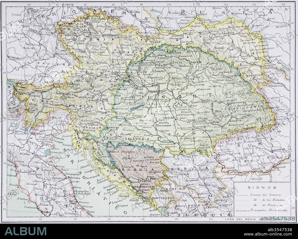
Map of the Austro-Hungarian empire at the turn of the 20th century
| Teilen |
|---|
 Pinterest Pinterest |
 Twitter Twitter |
 Facebook Facebook |
 Link kopieren Link kopieren |
 Email Email |
|
Zu einem anderen Lightbox hinzufügen |
|
Zu einem anderen Lightbox hinzufügen |


Haben Sie bereits ein Konto? Anmelden
Sie haben kein Konto? Registrieren
Dieses Bild kaufen.
Nutzung auswählen:

Titel: Map of the Austro-Hungarian empire at the turn of the 20th century
Untertitel: Siehe automatische Übersetzung
Map of the Austro-Hungarian empire at the turn of the 20th century. Map is in Spanish language. From Enciclopedia Ilustrada Seguí, published Barcelona circa 1910.
Map of the Austro-Hungarian empire at the turn of the 20th century. Map is in Spanish language. From Enciclopedia Ilustrada Seguí, published Barcelona circa 1910.
Bildnachweis: Album / Universal Images Group / Universal History Archive
Freigaben (Releases): ? Modellfreigabe: Nein - ? Eigentumsfreigabe: Nein
Rechtefragen?
Rechtefragen?
Bildgröße: 5079 × 3815 px | 55.4 MB
Druckgröße: 43.0 × 32.3 cm | 1999.6 × 1502.0 in (300 dpi)
Schlüsselwörter: ERSTER, ERSTE, ERSTES • FEUER, KRIEG • KARTE (KARTHOGRAFIE) • KARTEN • KARTHOGRAPHIE • KRIEG • KÖNIGREICH • LANDKARTE • PLAN (KARTOGRAPHIE) • UNGARN • WELT • ÖSTERREICH-UNGARN
