alb4062162
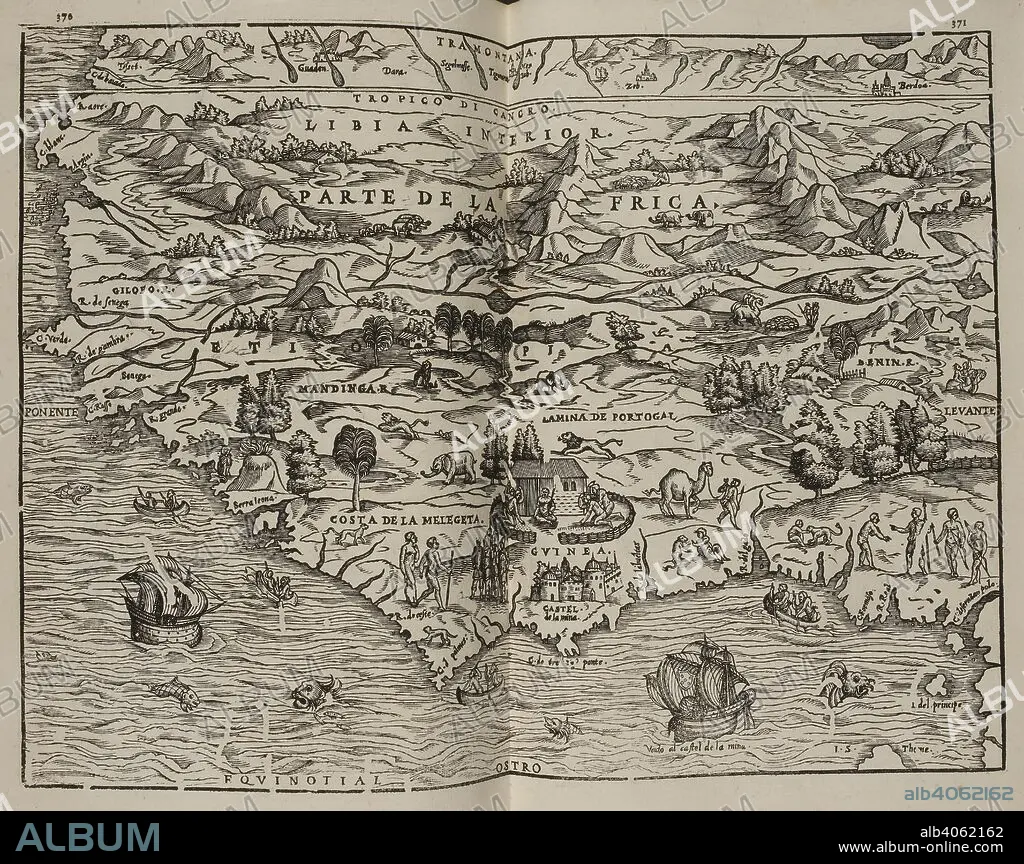
Mapa del Parte de la Frica. Coleccion de los viages y descubrimientos que hicieron por mar los Españoles desde fines del siglo XV. Madrid. Image taken from Collection of voyages and discoveries made by sea the Spaniards from the late fifteenth century. With several unpublished documents concerning the history of the Marina Castellana and the Spanish settlements in the Indies. Coordinated and illustrated by M. F. N.Published in 1825-37. Source: G.6823 370-371. Language: Spanish.
| Teilen |
|---|
 Pinterest Pinterest |
 Twitter Twitter |
 Facebook Facebook |
 Link kopieren Link kopieren |
 Email Email |
|
Zu einem anderen Lightbox hinzufügen |
|
Zu einem anderen Lightbox hinzufügen |


Haben Sie bereits ein Konto? Anmelden
Sie haben kein Konto? Registrieren
Dieses Bild kaufen.
Nutzung auswählen:

Untertitel: Siehe automatische Übersetzung
Mapa del Parte de la Frica. Coleccion de los viages y descubrimientos que hicieron por mar los Españoles desde fines del siglo XV. Madrid. Image taken from Collection of voyages and discoveries made by sea the Spaniards from the late fifteenth century. With several unpublished documents concerning the history of the Marina Castellana and the Spanish settlements in the Indies. Coordinated and illustrated by M. F. N.Published in 1825-37. Source: G.6823 370-371. Language: Spanish.
Mapa del Parte de la Frica. Coleccion de los viages y descubrimientos que hicieron por mar los Españoles desde fines del siglo XV. Madrid. Image taken from Collection of voyages and discoveries made by sea the Spaniards from the late fifteenth century. With several unpublished documents concerning the history of the Marina Castellana and the Spanish settlements in the Indies. Coordinated and illustrated by M. F. N.Published in 1825-37. Source: G.6823 370-371. Language: Spanish.
Bildnachweis: Album / British Library
Freigaben (Releases): ? Modellfreigabe: Nein - ? Eigentumsfreigabe: Nein
Rechtefragen?
Rechtefragen?
Bildgröße: 6008 × 4760 px | 81.8 MB
Druckgröße: 50.9 × 40.3 cm | 2365.4 × 1874.0 in (300 dpi)
Schlüsselwörter: AFRIKA • KARTE (KARTHOGRAFIE) • KARTEN • KARTHOGRAPHIE • LANDKARTE • PLAN (KARTOGRAPHIE) • SÜDAFRIKA
