alb4088374
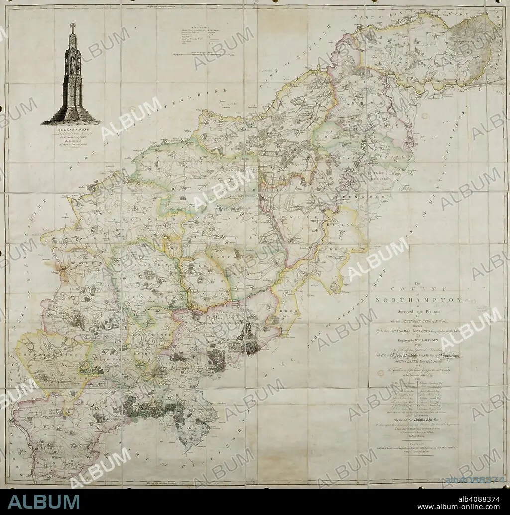
THOMAS JEFFREYS und W FADEN. 18th century map of the county of Northamptonshire. . The County of Northamptonshire, as surveyed and planned by the late T. Eyre, revised by the late T. Jefferys, and engraved by W. Faden. London, 1779. Source: Maps*4420.(3).
| Teilen |
|---|
 Pinterest Pinterest |
 Twitter Twitter |
 Facebook Facebook |
 Link kopieren Link kopieren |
 Email Email |
|
Zu einem anderen Lightbox hinzufügen |
|
Zu einem anderen Lightbox hinzufügen |


Haben Sie bereits ein Konto? Anmelden
Sie haben kein Konto? Registrieren
Dieses Bild kaufen.
Nutzung auswählen:

Autor: THOMAS JEFFREYS • W FADEN
Untertitel: Siehe automatische Übersetzung
18th century map of the county of Northamptonshire. . The County of Northamptonshire, as surveyed and planned by the late T. Eyre, revised by the late T. Jefferys, and engraved by W. Faden. London, 1779. Source: Maps*4420.(3).
18th century map of the county of Northamptonshire. . The County of Northamptonshire, as surveyed and planned by the late T. Eyre, revised by the late T. Jefferys, and engraved by W. Faden. London, 1779. Source: Maps*4420.(3).
Bildnachweis: Album / British Library
Freigaben (Releases): ? Modellfreigabe: Nein - ? Eigentumsfreigabe: Nein
Rechtefragen?
Rechtefragen?
Bildgröße: 6647 × 6367 px | 121.1 MB
Druckgröße: 56.3 × 53.9 cm | 2616.9 × 2506.7 in (300 dpi)
Schlüsselwörter: 18. JAHRHUNDERT • 18. JH. • ENGLAND • EUROPA • FADEN, W • FARBE • FARBEN • FARBIG • GROSSBRITANNIEN • JEFFREYS, THOMAS • KARTE (KARTHOGRAFIE) • KARTEN • KARTHOGRAFIE • KARTHOGRAPHIE • KARTOGRAFIE (KARTE) • KARTOGRAPHIE • LANDKARTE • PLAN (KARTOGRAPHIE) • WISSENSCH.: KARTOGRAPHIE
