alb4632971
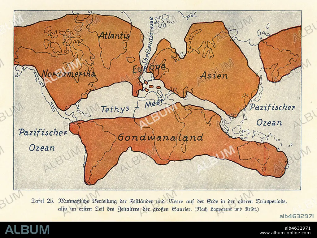
Map of the continents and seas in the Upper Triassic period. North America, Atlantis, Europe, Asia, Gondwanaland. Colour print after an illustration from Wilhelm Bolsches Das Leben der Urwelt, Prehistoric Life, Georg Dollheimer, Leipzig, 1932.
| Teilen |
|---|
 Pinterest Pinterest |
 Twitter Twitter |
 Facebook Facebook |
 Link kopieren Link kopieren |
 Email Email |
|
Zu einem anderen Lightbox hinzufügen |
|
Zu einem anderen Lightbox hinzufügen |


Haben Sie bereits ein Konto? Anmelden
Sie haben kein Konto? Registrieren
Dieses Bild kaufen.
Nutzung auswählen:

Untertitel: Siehe automatische Übersetzung
Map of the continents and seas in the Upper Triassic period. North America, Atlantis, Europe, Asia, Gondwanaland. Colour print after an illustration from Wilhelm Bolsches Das Leben der Urwelt, Prehistoric Life, Georg Dollheimer, Leipzig, 1932.
Map of the continents and seas in the Upper Triassic period. North America, Atlantis, Europe, Asia, Gondwanaland. Colour print after an illustration from Wilhelm Bolsches Das Leben der Urwelt, Prehistoric Life, Georg Dollheimer, Leipzig, 1932.
Bildnachweis: Album / Florilegius
Freigaben (Releases): ? Modellfreigabe: Nein - ? Eigentumsfreigabe: Nein
Rechtefragen?
Rechtefragen?
Bildgröße: 6581 × 4605 px | 86.7 MB
Druckgröße: 55.7 × 39.0 cm | 2590.9 × 1813.0 in (300 dpi)
Schlüsselwörter: ASIEN • ASIEN, KONTINENT • EUROPA • ILLUSTRATION • ILLUSTRATIONS • KARTE (KARTHOGRAFIE) • KARTEN • KARTHOGRAPHIE • KONTINENT, ASIEN • LANDKARTE • MEER • MEERE • OZEAN • PALAEONTOLOGIE • PALÄONTOLOGIE • PLAN (KARTOGRAPHIE) • SEA • SEESTUECK (GEMAELDE) • ZOOLOGIE
