alb5465123
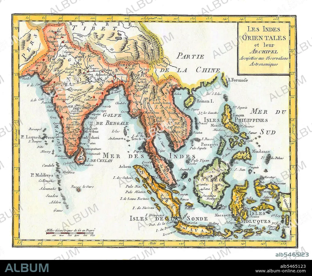
East Indies', hand coloured map by Joseph de LaPorte,1799.
| Teilen |
|---|
 Pinterest Pinterest |
 Twitter Twitter |
 Facebook Facebook |
 Link kopieren Link kopieren |
 Email Email |
|
Zu einem anderen Lightbox hinzufügen |
|
Zu einem anderen Lightbox hinzufügen |


Haben Sie bereits ein Konto? Anmelden
Sie haben kein Konto? Registrieren
Dieses Bild kaufen.
Nutzung auswählen:

Titel:
East Indies', hand coloured map by Joseph de LaPorte,1799.
Untertitel:
Siehe automatische Übersetzung
East Indies is a term used by Europeans from the 16th century onwards to identify what is now known as the Indian subcontinent or South Asia, Southeastern Asia, and the islands of Oceania, including the Malay Archipelago and the Philippines. The term has traditionally excluded China, Japan, and other countries to the north of India and the Himalayas. The names 'India' and 'the Indies', derived from the Indus River in modern-day Pakistan, were applied by the ancient Greeks to most of the regions of Asia that lay further to the east than Persia. This usage dates at least from the time of Herodotus, in the 5th century BCE.
Bildnachweis:
Album / Pictures From History/Universal Images Group
Freigaben (Releases):
Bildgröße:
4600 x 3839 px | 50.5 MB
Druckgröße:
38.9 x 32.5 cm | 15.3 x 12.8 in (300 dpi)
Schlüsselwörter:
