alb4542016
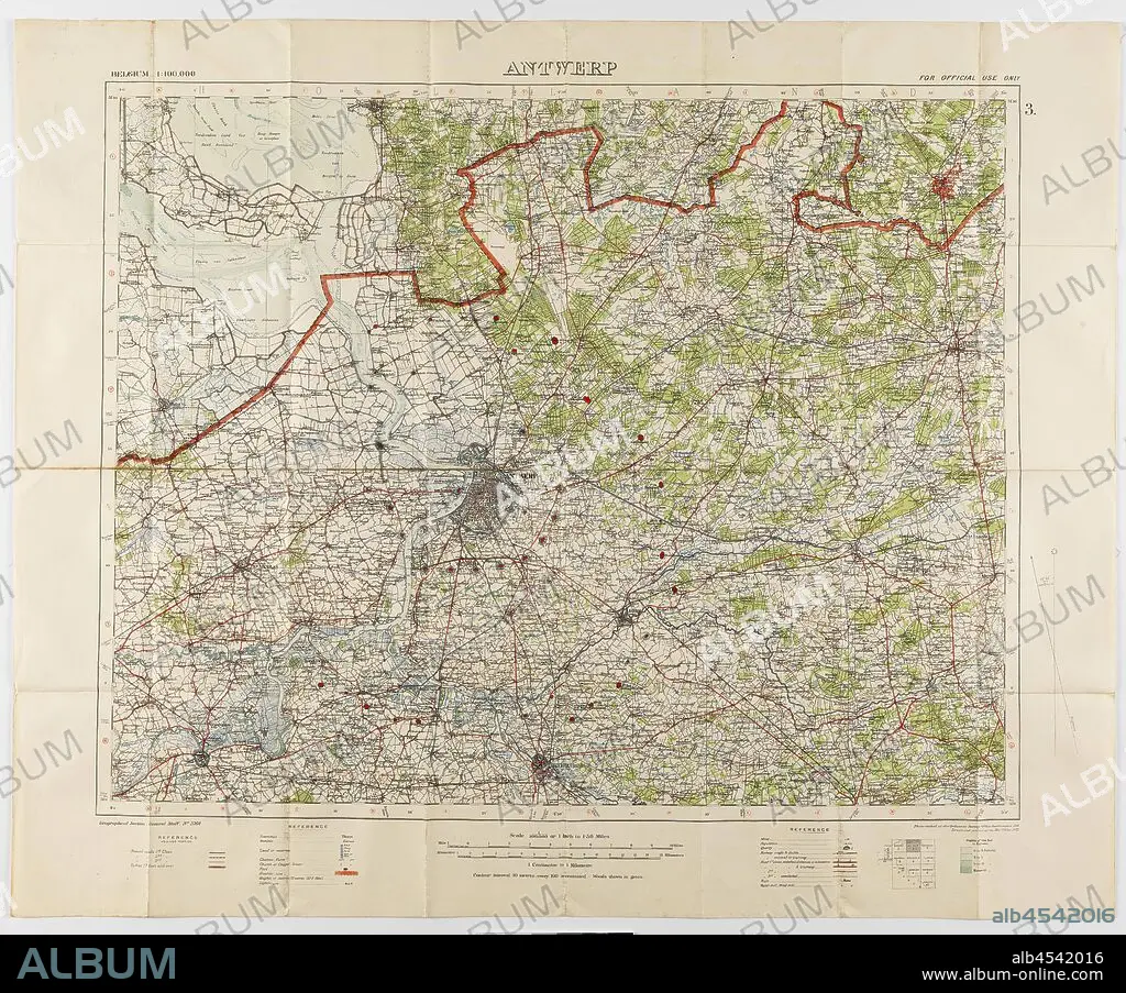
Map - Military, Belgium, Antwerp 3, Scale 1:100,000, 1912, Military map, Belgium, Antwerp, 3 scale 1:100,000. Labelled 'Georgaphical Section General Staff no. 2364', the map was photo-etched at the Ordnance Survey Office, Southampton, England, in 1911, and was drawn and printed at the War Office in 1912. The map was used by Captain Morris Lewis during World War I. Captain Lewis, 44th Battalion, Third Division, First AIF, was born in Wales in 1892 of.
| Teilen |
|---|
 Pinterest Pinterest |
 Twitter Twitter |
 Facebook Facebook |
 Link kopieren Link kopieren |
 Email Email |
|
Zu einem anderen Lightbox hinzufügen |
|
Zu einem anderen Lightbox hinzufügen |


Haben Sie bereits ein Konto? Anmelden
Sie haben kein Konto? Registrieren
Dieses Bild kaufen.
Nutzung auswählen:

Untertitel:
Siehe automatische Übersetzung
Map - Military, Belgium, Antwerp 3, Scale 1:100,000, 1912, Military map, Belgium, Antwerp, 3 scale 1:100,000. Labelled 'Georgaphical Section General Staff no. 2364', the map was photo-etched at the Ordnance Survey Office, Southampton, England, in 1911, and was drawn and printed at the War Office in 1912. The map was used by Captain Morris Lewis during World War I. Captain Lewis, 44th Battalion, Third Division, First AIF, was born in Wales in 1892 of
Bildnachweis:
Album / quintlox
Freigaben (Releases):
Bildgröße:
3900 x 3238 px | 36.1 MB
Druckgröße:
33.0 x 27.4 cm | 13.0 x 10.8 in (300 dpi)
Schlüsselwörter:
