alb5409621
Slave Trade of Africa Map,1899
| Teilen |
|---|
 Pinterest Pinterest |
 Twitter Twitter |
 Facebook Facebook |
 Link kopieren Link kopieren |
 Email Email |
|
Zu einem anderen Lightbox hinzufügen |
|
Zu einem anderen Lightbox hinzufügen |


Haben Sie bereits ein Konto? Anmelden
Sie haben kein Konto? Registrieren
Dieses Bild kaufen.
Nutzung auswählen:

Titel: Slave Trade of Africa Map,1899
Untertitel: Siehe automatische Übersetzung
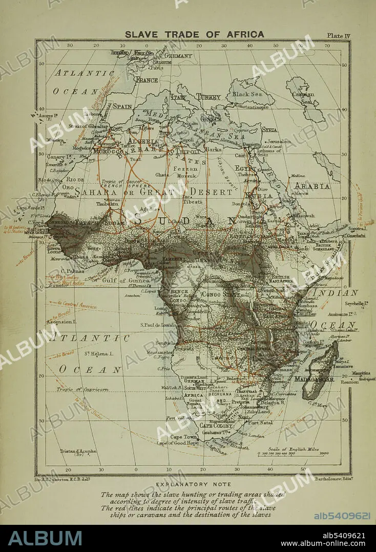
A map of the slave trade in Africa that shows the regions of most intense activity. The map shows the slave hunting or trading areas shaded according to degree of intensity of slave traffic. The red lines indicate the principal routes of the slave ships or caravans and the destination of the slaves.
A map of the slave trade in Africa that shows the regions of most intense activity. The map shows the slave hunting or trading areas shaded according to degree of intensity of slave traffic. The red lines indicate the principal routes of the slave ships or caravans and the destination of the slaves.
Bildnachweis: Album / NYPL/Science Source
Freigaben (Releases): ? Modellfreigabe: Nein - ? Eigentumsfreigabe: Nein
Rechtefragen?
Rechtefragen?
Bildgröße: 3441 × 4800 px | 47.3 MB
Druckgröße: 29.1 × 40.6 cm | 1354.7 × 1889.8 in (300 dpi)
Schlüsselwörter: AFRIKA • KARTHOGRAFIE • KARTOGRAFIE (KARTE) • KARTOGRAPHIE • SKLAVEREI • WISSENSCH.: KARTOGRAPHIE
