alb3907891
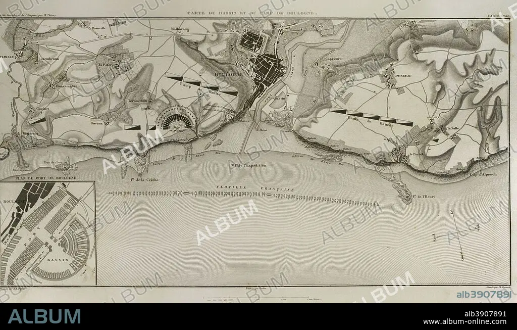
Map of Boulogne-sur-Mer. In French coast on the English Channel. it was a staging area for Napoleon's troops for several months in 1805, during his planned invasion of the United Kingdom. Atlas de l'Histoire du Consulat et de l'Empire. History of the Consulate and the Empire of France under Napoleon by Marie Joseph Louis Adolphe Thiers (1797-1877). Drawings by Dufour, engravings by Dyonnet. Edited in Paris, 1864.
| Teilen |
|---|
 Pinterest Pinterest |
 Twitter Twitter |
 Facebook Facebook |
 Link kopieren Link kopieren |
 Email Email |
|
Zu einem anderen Lightbox hinzufügen |
|
Zu einem anderen Lightbox hinzufügen |


Haben Sie bereits ein Konto? Anmelden
Sie haben kein Konto? Registrieren
Dieses Bild kaufen.
Nutzung auswählen:

Untertitel:
Siehe automatische Übersetzung
Map of Boulogne-sur-Mer. In French coast on the English Channel. it was a staging area for Napoleon's troops for several months in 1805, during his planned invasion of the United Kingdom. Atlas de l'Histoire du Consulat et de l'Empire. History of the Consulate and the Empire of France under Napoleon by Marie Joseph Louis Adolphe Thiers (1797-1877). Drawings by Dufour, engravings by Dyonnet. Edited in Paris, 1864.
Persönlichkeiten:
Bildnachweis:
Album / Prisma
Freigaben (Releases):
Bildgröße:
5079 x 2977 px | 43.3 MB
Druckgröße:
43.0 x 25.2 cm | 16.9 x 9.9 in (300 dpi)
Schlüsselwörter:
ALT (ALTER) • ALTERTÜMLICH • ANTIK • ARMADA • ARMEE • ARMY • BOULOGNE-SUR-MER • EINFALL • ENGLAND • EUROPA • EUROPAEER (F M) • EUROPAEER • EUROPÄER (F M) • EUROPÄER • EUROPÄISCH • FEUER, KRIEG • FLOTTE LOTTE • FLOTTE • FLOTTILLE • FRANKREICH • GEOGRAFIE • GEOGRAPHIE • GESCHICHTE • GRANDE ARMEE • GRAVUR • GROSSBRITANNIEN • HEER • ILLUSTRATION • ILLUSTRATIONS • KARTE (KARTHOGRAFIE) • KARTEN • KARTHOGRAFIE • KARTHOGRAPHIE • KARTOGRAFIE (KARTE) • KARTOGRAPHIE • KRIEG • KRIEG, NAPOLEONISCH • KUESTE • KÜSTE • LANDKARTE • MARINE • MARINEUNIFORM • MARITIM • NAPOLEON BONAPARTE • NAPOLEONISCHE KRIEGE • NAPOLEONISCHER KRIEG • PARIS • PARIS, FRANKREICH • PLAN (KARTOGRAPHIE) • STICH (KUNST) • STRATEGIE • TECHNIK: ZEICHNUNG • UNIFORM, MARINE • WISSENSCH.: KARTOGRAPHIE • ZEICHNEN • ZEICHNUNG • ZEITGESCHICHTE
