alb9006760
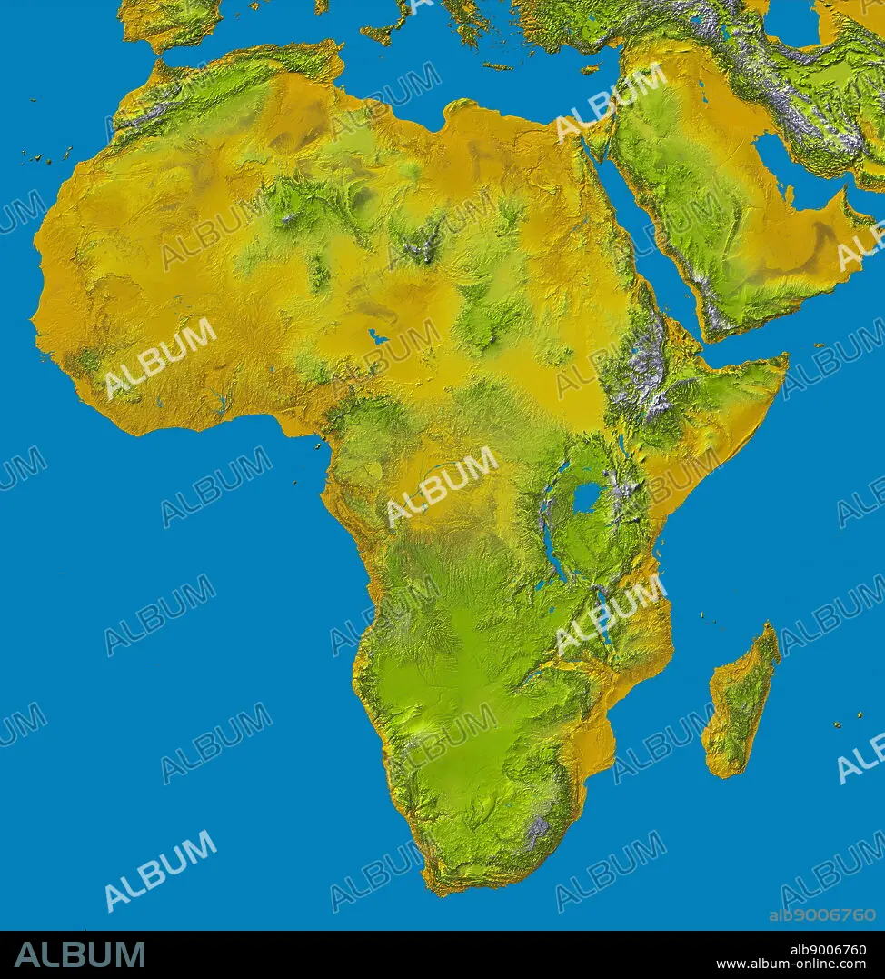
relief image of Africa by the Shuttle Radar Topography Mission (SRTM). This release in 2000,
| Teilen |
|---|
 Pinterest Pinterest |
 Twitter Twitter |
 Facebook Facebook |
 Link kopieren Link kopieren |
 Email Email |
|
Zu einem anderen Lightbox hinzufügen |
|
Zu einem anderen Lightbox hinzufügen |


Haben Sie bereits ein Konto? Anmelden
Sie haben kein Konto? Registrieren
Dieses Bild kaufen.
Nutzung auswählen:

Titel:
relief image of Africa by the Shuttle Radar Topography Mission (SRTM). This release in 2000,
Untertitel:
Siehe automatische Übersetzung
relief image of Africa by the Shuttle Radar Topography Mission (SRTM). This release in 2000, includes data for all of the continent, plus the island of Madagascar and the Arabian Peninsula. The central latitudes of Africa is dominated by the Great Rift Valley, extending from Lake Nyasa to the Red Sea. To the west lies the Congo Basin. Most of the southern part of the continent rests on a concave plateau comprising the Kalahari basin. color-coding is directly related to topographic height, with brown and yellow at the lower elevations, rising through green, to white at the highest elevations. Blue areas on the map represent water within the mapped tiles, each of which includes shorelines or islands.
Bildnachweis:
Album / World History Archive
Freigaben (Releases):
Model: Nein - Eigentum: Nein
Rechtefragen?
Rechtefragen?
Bildgröße:
4466 x 4696 px | 60.0 MB
Druckgröße:
37.8 x 39.8 cm | 14.9 x 15.7 in (300 dpi)
