alb1642737
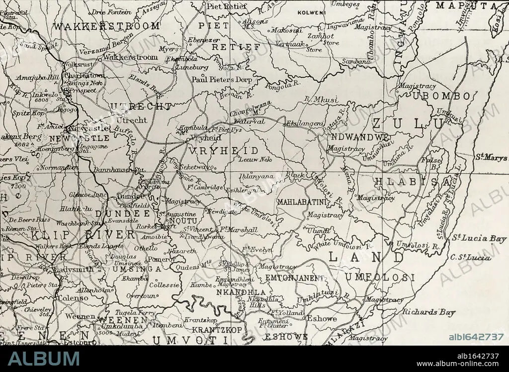
Map of Zululand and adjoining portions of Natal at the end of the 19th century. From the book South Africa and the Transvaal War, Volume 1 by Louis Creswicke, published 1900.
| Teilen |
|---|
 Pinterest Pinterest |
 Twitter Twitter |
 Facebook Facebook |
 Link kopieren Link kopieren |
 Email Email |
|
Zu einem anderen Lightbox hinzufügen |
|
Zu einem anderen Lightbox hinzufügen |


Haben Sie bereits ein Konto? Anmelden
Sie haben kein Konto? Registrieren
Dieses Bild kaufen.
Nutzung auswählen:

Untertitel:
Siehe automatische Übersetzung
Map of Zululand and adjoining portions of Natal at the end of the 19th century. From the book South Africa and the Transvaal War, Volume 1 by Louis Creswicke, published 1900.
Bildnachweis:
Album / Universal History Archive/Universal Images Group
Freigaben (Releases):
Model: Nein - Eigentum: Nein
Rechtefragen?
Rechtefragen?
Bildgröße:
5362 x 3639 px | 55.8 MB
Druckgröße:
45.4 x 30.8 cm | 17.9 x 12.1 in (300 dpi)
Schlüsselwörter:
AFRIKA • AFRIKANER • AFRIKANERIN • AFRIKANISCH • FEUER, KRIEG • KARTE (KARTHOGRAFIE) • KARTEN • KARTHOGRAPHIE • KEN • KONFLIKT • KONFLIKTE • KRIEG • LANDKARTE • PLAN (KARTOGRAPHIE) • SUEDEN • SÜDEN • ZULU
