alb1656551
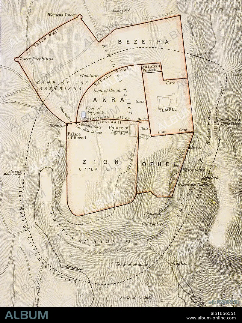
City map of ancient Jerusalem From The Citizen's Atlas of the World published London circa 1899.
| Teilen |
|---|
 Pinterest Pinterest |
 Twitter Twitter |
 Facebook Facebook |
 Link kopieren Link kopieren |
 Email Email |
|
Zu einem anderen Lightbox hinzufügen |
|
Zu einem anderen Lightbox hinzufügen |


Haben Sie bereits ein Konto? Anmelden
Sie haben kein Konto? Registrieren
Dieses Bild kaufen

Untertitel:
Siehe automatische Übersetzung
City map of ancient Jerusalem From The Citizen's Atlas of the World published London circa 1899
Bildnachweis:
Album / Universal History Archive/Universal Images Group
Freigaben (Releases):
Model: Nein - Eigentum: Nein
Rechtefragen?
Rechtefragen?
Bildgröße:
3822 x 4843 px | 53.0 MB
Druckgröße:
32.4 x 41.0 cm | 12.7 x 16.1 in (300 dpi)
Schlüsselwörter:
ALT (ALTER) • ALTERTÜMLICH • ANTIK • BIBLISCH • FARBE • FARBIG • JERUSALEM • JERUSALEM, STADTANSICHT • KARTE (KARTHOGRAFIE) • KARTEN • KARTHOGRAPHIE • KEN • LANDKARTE • PLAN (KARTOGRAPHIE) • PLAN • STADT • STADTANSICHT: JERUSALEM • STÄDTE • VERTIKALE
