alb5408093
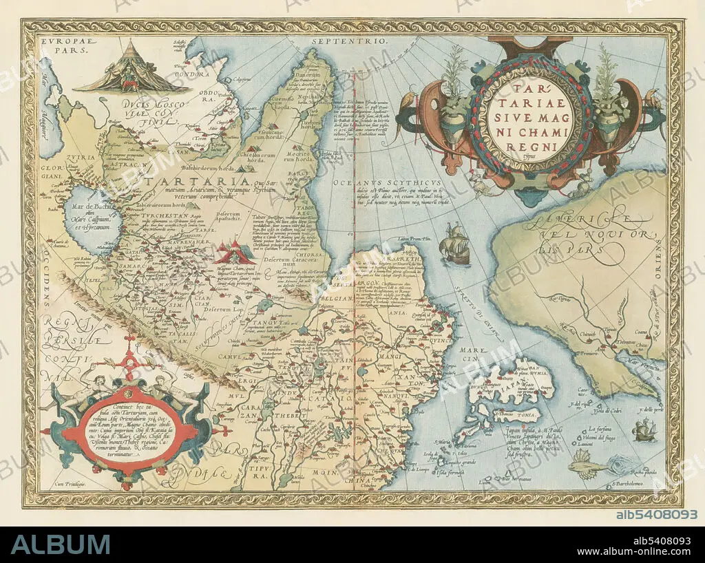
Theatrum Orbis Terrarum, Tartaria,1570
| Teilen |
|---|
 Pinterest Pinterest |
 Twitter Twitter |
 Facebook Facebook |
 Link kopieren Link kopieren |
 Email Email |
|
Zu einem anderen Lightbox hinzufügen |
|
Zu einem anderen Lightbox hinzufügen |


Haben Sie bereits ein Konto? Anmelden
Sie haben kein Konto? Registrieren
Dieses Bild kaufen

Titel:
Theatrum Orbis Terrarum, Tartaria,1570
Untertitel:
Siehe automatische Übersetzung
Tartaria sive magni chami imperium. Die Tatarei oder das reich des grosskhans. The Tartarei or the kingdom of the big khan. Theatrum Orbis Terrarum (Theatre of the World) is considered to be the first true modern atlas. Written by Abraham Ortelius and originally printed on May 20, 1570, in Antwerp, it consisted of a collection of uniform map sheets and sustaining text bound to form a book for which copper printing plates were specifically engraved. The Ortelius atlas is sometimes referred to as the summary of 16th cartography and the first time that the entirety of Western European knowledge of the world was brought together in one book. Most of the maps were admittedly reproductions, and many discrepancies of delineation or nomenclature occur. From its original 70 maps and 87 bibliographic references in the first edition (1570), the atlas grew through its 31 editions to encompass 183 references and 167 maps in 1612.
Bildnachweis:
Album / Science Source
Freigaben (Releases):
Model: Nein - Eigentum: Nein
Rechtefragen?
Rechtefragen?
Bildgröße:
5274 x 3939 px | 59.4 MB
Druckgröße:
44.7 x 33.4 cm | 17.6 x 13.1 in (300 dpi)
Schlüsselwörter:
