alb4011016
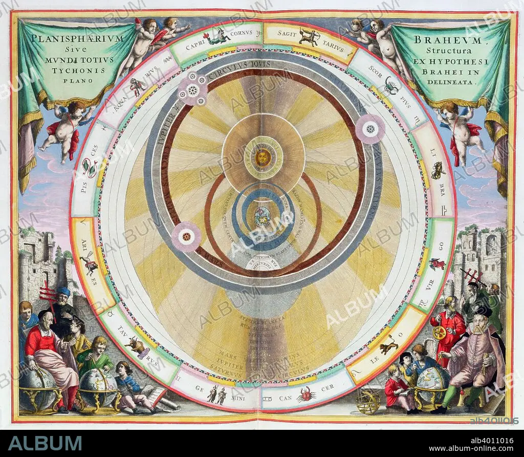
Map showing Tycho Brahe's system of planetary orbits, 1660-1661. Artist: Andreas Cellarius
| Teilen |
|---|
 Pinterest Pinterest |
 Twitter Twitter |
 Facebook Facebook |
 Link kopieren Link kopieren |
 Email Email |
|
Zu einem anderen Lightbox hinzufügen |
|
Zu einem anderen Lightbox hinzufügen |


Haben Sie bereits ein Konto? Anmelden
Sie haben kein Konto? Registrieren
Dieses Bild kaufen

Titel:
Map showing Tycho Brahe's system of planetary orbits, 1660-1661. Artist: Andreas Cellarius
Untertitel:
Siehe automatische Übersetzung
Map showing Tycho Brahe's system of planetary orbits, 1660-1661. From The Celestial Atlas, or The Harmony of the Universe (Atlas coelestis seu harmonia macrocosmica) by Andreas Cellarius, published by Johannes Janssonius, (Amsterdam 1660-1661).
Bildnachweis:
Album / Heritage Images / Historica Graphica Collection
Freigaben (Releases):
Model: Nein - Eigentum: Nein
Rechtefragen?
Rechtefragen?
Bildgröße:
4648 x 3809 px | 50.7 MB
Druckgröße:
39.4 x 32.2 cm | 15.5 x 12.7 in (300 dpi)
Schlüsselwörter:
ASTROLOGIE • ASTRONOMIE • DÄNEMARK • FARBE • FARBIG • HOLLAND • PLANET ALLE • PLANET • SONNENSYSTEM • THÉORIE • UMLAUFBAHN • WELTRAUM • WISSENSCH.: ASTRONOMIE
