alb9433967
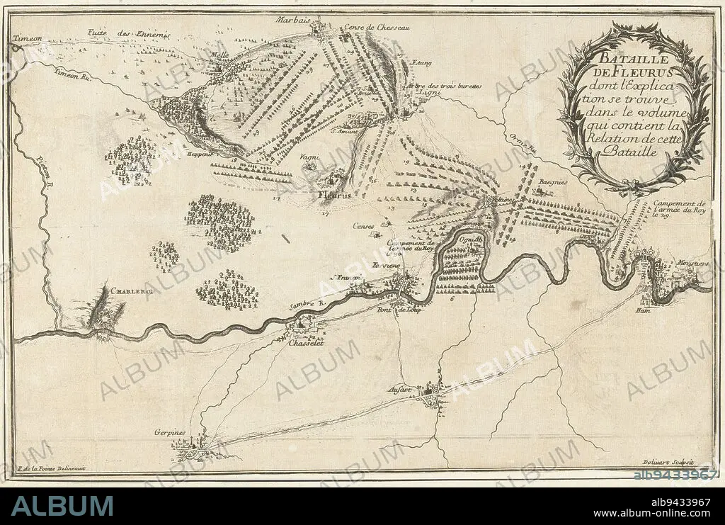
Map of the Fleurus area near Charleroi showing the positions of the armies at the battle of Fleurus, a victory of the French under the Duke of Luxembourg over the Allied army under the Prince of Waldeck, 1 July 1690, Battle of Fleurus, 1690 Bataille de Fleurus , print maker: Juan Dolívar, (mentioned on object), intermediary draughtsman: François de La Pointe, (mentioned on object), France, 1690, paper, etching, h 243 mm × w 370 mm.
| Teilen |
|---|
 Pinterest Pinterest |
 Twitter Twitter |
 Facebook Facebook |
 Link kopieren Link kopieren |
 Email Email |
|
Zu einem anderen Lightbox hinzufügen |
|
Zu einem anderen Lightbox hinzufügen |


Haben Sie bereits ein Konto? Anmelden
Sie haben kein Konto? Registrieren
Dieses Bild kaufen.
Nutzung auswählen:

Untertitel:
Siehe automatische Übersetzung
Map of the Fleurus area near Charleroi showing the positions of the armies at the battle of Fleurus, a victory of the French under the Duke of Luxembourg over the Allied army under the Prince of Waldeck, 1 July 1690, Battle of Fleurus, 1690 Bataille de Fleurus , print maker: Juan Dolívar, (mentioned on object), intermediary draughtsman: François de La Pointe, (mentioned on object), France, 1690, paper, etching, h 243 mm × w 370 mm
Persönlichkeiten:
Bildnachweis:
Album / quintlox
Freigaben (Releases):
Model: Nein - Eigentum: Nein
Rechtefragen?
Rechtefragen?
Bildgröße:
5590 x 3754 px | 60.0 MB
Druckgröße:
47.3 x 31.8 cm | 18.6 x 12.5 in (300 dpi)
Schlüsselwörter:
ARMEE • ARMY • FUERST • FÜRST • HEER • HERZOG • JUAN DOLIVAR • KARTE (KARTHOGRAFIE) • KARTEN • KARTHOGRAPHIE • LANDKARTE • LUXEMBURG • OBJEKT • PAPIER • PLAN (KARTOGRAPHIE) • PRINZ • SCHLACHT VON BORODINO • SCHLACHT
