alb3828222
Typhoon, Navy Ship Radar
| Teilen |
|---|
 Pinterest Pinterest |
 Twitter Twitter |
 Facebook Facebook |
 Link kopieren Link kopieren |
 Email Email |
|
Zu einem anderen Lightbox hinzufügen |
|
Zu einem anderen Lightbox hinzufügen |


Haben Sie bereits ein Konto? Anmelden
Sie haben kein Konto? Registrieren
Dieses Bild kaufen.
Nutzung auswählen:

Titel:
Typhoon, Navy Ship Radar
Untertitel:
Siehe automatische Übersetzung
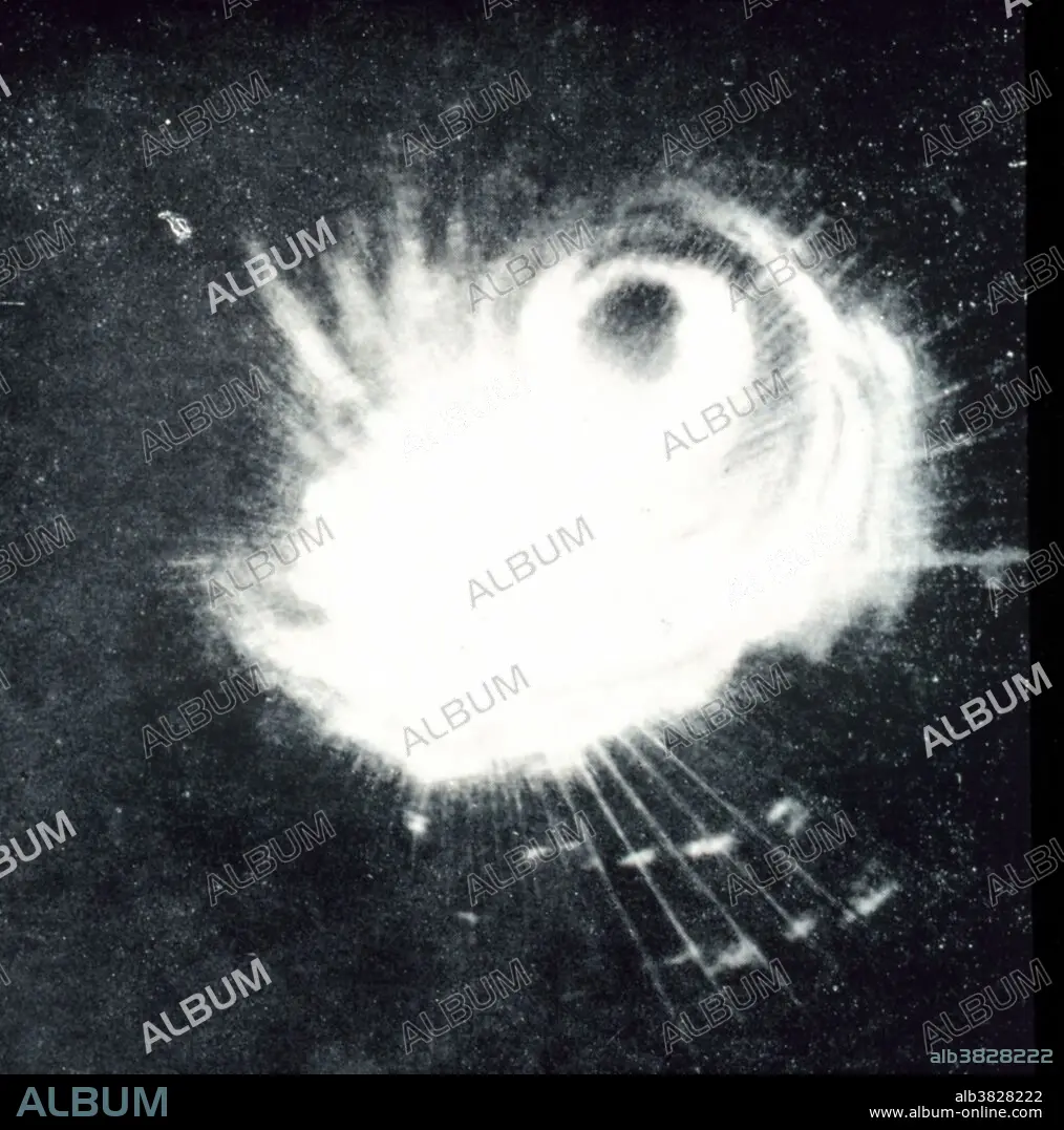
Structure of a typhoon captured by a Navy ship's radar. This storm was the second tropical storm to ever be observed on radar. Philippine Islands, area to east. December 18, 1944. A typhoon is a tropical cyclone or hurricane of the western Pacific area and the China seas.
Bildnachweis:
Album / NOAA/Science Source
Freigaben (Releases):
Model: Nein - Eigentum: Nein
Rechtefragen?
Rechtefragen?
Bildgröße:
3300 x 3334 px | 31.5 MB
Druckgröße:
27.9 x 28.2 cm | 11.0 x 11.1 in (300 dpi)
Schlüsselwörter:
