alb4466651
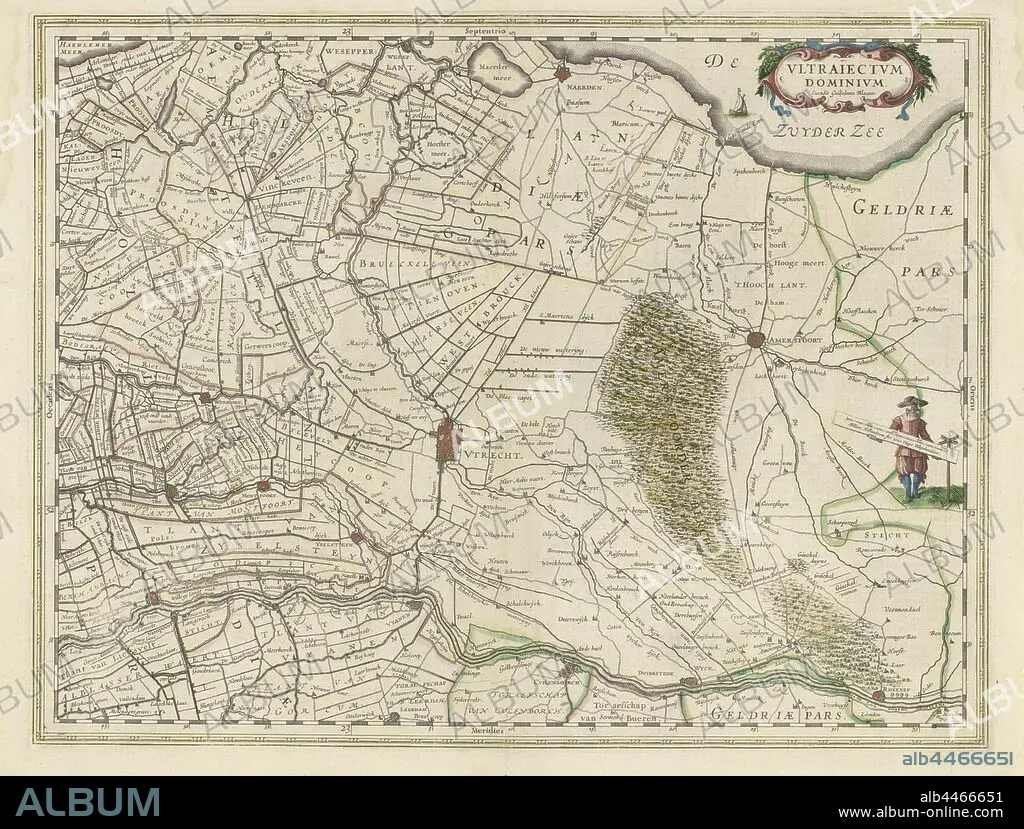
Map of the province of Utrecht, Vltraiectvm Dominivm (title on object), Map of the province of Utrecht on a scale of 1: 150 000 with the north on the right. Top right a cartouche with the title. Right: a standing surveyor with a distance bar in his hand that indicates a scale in Dutch miles, maps of separate countries or regions, Eemland, Willem Janszoon Blaeu (mentioned on object), 1630, paper, engraving, h 387 mm × w 505 mm.
| Teilen |
|---|
 Pinterest Pinterest |
 Twitter Twitter |
 Facebook Facebook |
 Link kopieren Link kopieren |
 Email Email |
|
Zu einem anderen Lightbox hinzufügen |
|
Zu einem anderen Lightbox hinzufügen |


Haben Sie bereits ein Konto? Anmelden
Sie haben kein Konto? Registrieren
Dieses Bild kaufen

Untertitel:
Siehe automatische Übersetzung
Map of the province of Utrecht, Vltraiectvm Dominivm (title on object), Map of the province of Utrecht on a scale of 1: 150 000 with the north on the right. Top right a cartouche with the title. Right: a standing surveyor with a distance bar in his hand that indicates a scale in Dutch miles, maps of separate countries or regions, Eemland, Willem Janszoon Blaeu (mentioned on object), 1630, paper, engraving, h 387 mm × w 505 mm
Bildnachweis:
Album / quintlox
Freigaben (Releases):
Model: Nein - Eigentum: Nein
Rechtefragen?
Rechtefragen?
Bildgröße:
5023 x 3808 px | 54.7 MB
Druckgröße:
42.5 x 32.2 cm | 16.7 x 12.7 in (300 dpi)
Schlüsselwörter:
GRAVUR • HAENDE • HAND • HÄNDE • KARTE (KARTHOGRAFIE) • KARTEN • KARTHOGRAPHIE • LANDKARTE • NORDEN • OBJEKT • PAPIER • PLAN (KARTOGRAPHIE) • PROVINZ • REGIONEN • STICH (KUNST)
