alb3844393
Hurricane Emily, 2005
| Teilen |
|---|
 Pinterest Pinterest |
 Twitter Twitter |
 Facebook Facebook |
 Link kopieren Link kopieren |
 Email Email |
|
Zu einem anderen Lightbox hinzufügen |
|
Zu einem anderen Lightbox hinzufügen |


Haben Sie bereits ein Konto? Anmelden
Sie haben kein Konto? Registrieren
Dieses Bild kaufen

Titel:
Hurricane Emily, 2005
Untertitel:
Siehe automatische Übersetzung
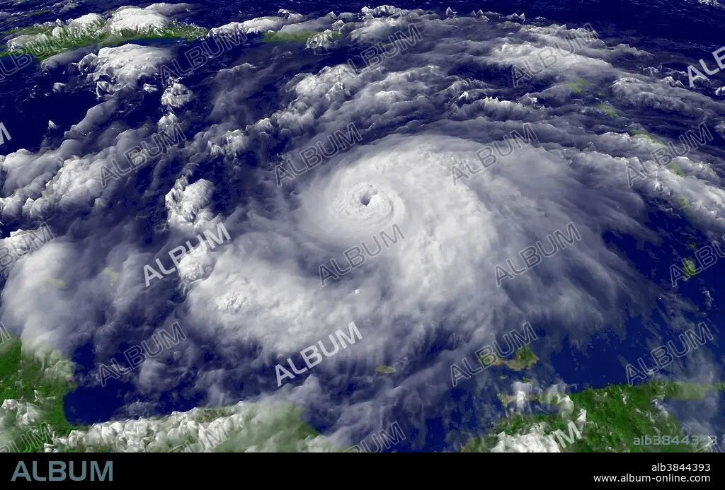
Hurricane Emily regional imagery, 2005.07.14 at 1915Z. Centerpoint Latitude: 13:15:06N Longitude: 65:23:34W. Hurricane Emily was a powerful, early season tropical cyclone that caused significant damage across the Caribbean Sea to Mexico. A Cape Verde-type hurricane, the storm formed on July 10, 2005, in the central Atlantic Ocean before passing through the Windward Islands on July 14. Tracking generally towards the west-northwest, the storm gradually intensified as it traversed the Caribbean, peaking as a Category 5 hurricane on July 16, marking the earliest date for a storm to do so during the course of a given year. The system subsequently made landfall in the Yucatán Peninsula as a Category 4. Quickly crossing the peninsula, Emily emerged into the Gulf of Mexico and reorganized. On July 20, the storm struck Tamaulipas as a major hurricane and rapidly dissipated within 24 hours. Hurricane Emily was also the earliest Category 5 hurricane ever recorded in the Atlantic basin (beating Hurricane Allen's old record by nearly three weeks) and the only Category 5 hurricane ever recorded before August.
Bildnachweis:
Album / NOAA/Science Source
Freigaben (Releases):
Model: Nein - Eigentum: Nein
Rechtefragen?
Rechtefragen?
Bildgröße:
4500 x 2813 px | 36.2 MB
Druckgröße:
38.1 x 23.8 cm | 15.0 x 9.4 in (300 dpi)
Schlüsselwörter:
