alb3800902
WWI, Satirical War Map of Europe, 1914
| Teilen |
|---|
 Pinterest Pinterest |
 Twitter Twitter |
 Facebook Facebook |
 Link kopieren Link kopieren |
 Email Email |
|
Zu einem anderen Lightbox hinzufügen |
|
Zu einem anderen Lightbox hinzufügen |


Haben Sie bereits ein Konto? Anmelden
Sie haben kein Konto? Registrieren
Dieses Bild kaufen.
Nutzung auswählen:

Titel: WWI, Satirical War Map of Europe, 1914
Untertitel: Siehe automatische Übersetzung
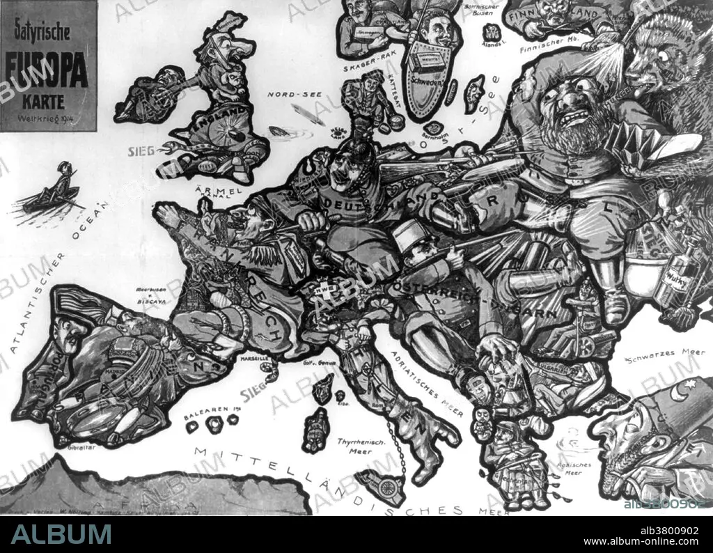
Entitled: Satyrische Europa Karte Weltkrieg 1914. Sketch depicting a map of Europe at the outbreak of the first World War with each country depicted as a human figure representative of the particular state of affairs or attitudes of the country, for instance, Germany is depicted as a soldier fighting with both Russia and France, while eyeing England.
Entitled: Satyrische Europa Karte Weltkrieg 1914. Sketch depicting a map of Europe at the outbreak of the first World War with each country depicted as a human figure representative of the particular state of affairs or attitudes of the country, for instance, Germany is depicted as a soldier fighting with both Russia and France, while eyeing England.
Bildnachweis: Album / LOC/Science Source
Freigaben (Releases): ? Modellfreigabe: Nein - ? Eigentumsfreigabe: Nein
Rechtefragen?
Rechtefragen?
Bildgröße: 4800 × 3475 px | 47.7 MB
Druckgröße: 40.6 × 29.4 cm | 1889.8 × 1368.1 in (300 dpi)
Schlüsselwörter: 1. WELTKRIEG • BERÜHMT • BERÜHMTE PERSÖNLICHKEIT • ENGLAND • EREIGNIS • ERSTER WELTKRIEG • FIRST WORLD WAR • ILLUSTRATION • ILLUSTRATIONS • ITALIEN • KRIEG, ERSTER WELTKRIEG • KRIEG, WELTKRIEG I • MANN • NOTABEL • PROMINENZ • SCHMAEHSCHRIFT • SCHOTTLAND • SCHWEDEN • SPANIEN • WELTKRIEG I • WESTFRONT • WORLD WAR 1 • WORLD WAR I • WORLD WAR ONE • WWI
