alb3822980
Map of Europe, 1600
| Teilen |
|---|
 Pinterest Pinterest |
 Twitter Twitter |
 Facebook Facebook |
 Link kopieren Link kopieren |
 Email Email |
|
Zu einem anderen Lightbox hinzufügen |
|
Zu einem anderen Lightbox hinzufügen |


Haben Sie bereits ein Konto? Anmelden
Sie haben kein Konto? Registrieren
Dieses Bild kaufen.
Nutzung auswählen:

Titel:
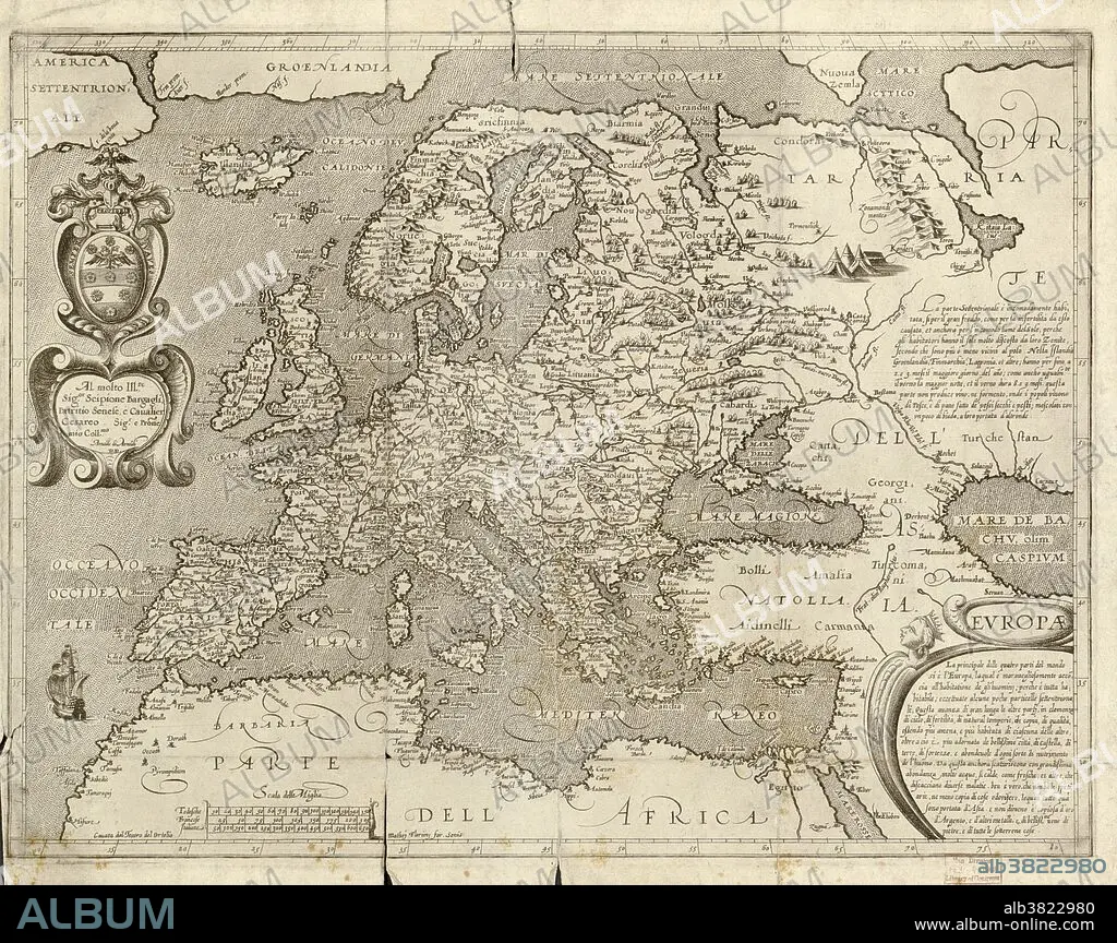
Map of Europe, 1600
Untertitel:
Siehe automatische Übersetzung
16th century map of Europe. Published in Sienna in 1600, this Italian map shows the latest knowledge of the geography of Europe. The writing is in Italian, and a dedication is given at upper left in a cartouche, along with the name of the cartographer, Arnoldo di Arnoldi (died 1602). Notes are given at far right, with the title at lower right. A scale bar is at lower left.
Bildnachweis:
Album / Science Source / LOC/Geography and Map Division
Freigaben (Releases):
Model: Nein - Eigentum: Nein
Rechtefragen?
Rechtefragen?
Bildgröße:
5998 x 4753 px | 81.6 MB
Druckgröße:
50.8 x 40.2 cm | 20.0 x 15.8 in (300 dpi)
Schlüsselwörter:
