alb9661383
Map of India, 1857. Creator: Unknown.
| Teilen |
|---|
 Pinterest Pinterest |
 Twitter Twitter |
 Facebook Facebook |
 Link kopieren Link kopieren |
 Email Email |
|
Zu einem anderen Lightbox hinzufügen |
|
Zu einem anderen Lightbox hinzufügen |


Haben Sie bereits ein Konto? Anmelden
Sie haben kein Konto? Registrieren
Dieses Bild kaufen

Titel:
Map of India, 1857. Creator: Unknown.
Untertitel:
Siehe automatische Übersetzung
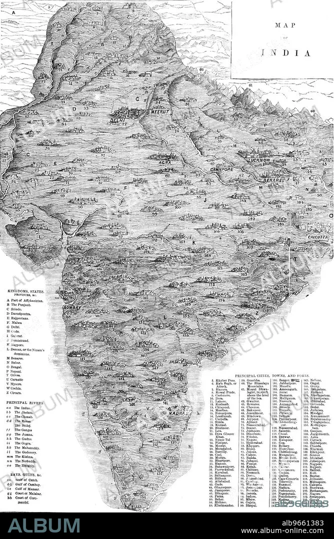
Map of India, 1857. Map of the Indian subcontinent during the British colonial period, showing 'Kingdoms, States, Provinces &c...Principal Rivers...Bays, Gulfs &c...Principal Cities, Towns, and Forts'. From "Illustrated London News", 1857.
Persönlichkeiten:
Bildnachweis:
Album / The Print Collector/Heritage Images
Freigaben (Releases):
Model: Nein - Eigentum: Nein
Rechtefragen?
Rechtefragen?
Bildgröße:
3755 x 5758 px | 61.9 MB
Druckgröße:
31.8 x 48.8 cm | 12.5 x 19.2 in (300 dpi)
Schlüsselwörter:
AFGHANISTAN • ASIEN • ASIEN, KONTINENT • BRITISCH-INDIEN • DELHI • FARBE • FARBIG • GEOGRAFIE • GEOGRAPHIE • IMPERIALISMUS • KOLONIALISMUS • KONTINENT, ASIEN • KUESTE • KÜSTE • MARITIM • SCHWARZ UND WEISS • SCHWARZ-WEIß • SCHWARZWEISS • TAMIL NADU • ZEITUNG
