alb5412107
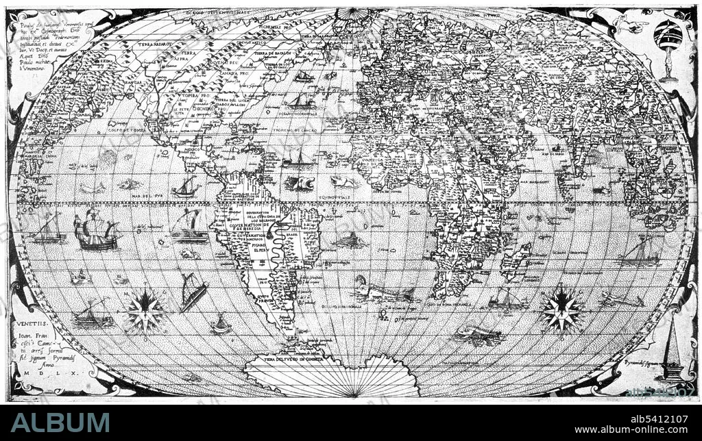
Giacomo Gastaldi, World Map,1560
| Teilen |
|---|
 Pinterest Pinterest |
 Twitter Twitter |
 Facebook Facebook |
 Link kopieren Link kopieren |
 Email Email |
|
Zu einem anderen Lightbox hinzufügen |
|
Zu einem anderen Lightbox hinzufügen |


Haben Sie bereits ein Konto? Anmelden
Sie haben kein Konto? Registrieren
Dieses Bild kaufen.
Nutzung auswählen:

Titel: Giacomo Gastaldi, World Map,1560
Untertitel: Siehe automatische Übersetzung
Giacomo Gastaldi (1500 - October 1566 in Venice) was an Italian cartographer, astronomer and engineer. From about 1544 he turned his attention entirely to mapmaking, and his work represents several important turning points in cartographic development. His 1548 edition of Ptolemy's Geography included regional maps of the Americas. Gastaldi and his publisher also reduced the size of the volume, thereby making the first pocket atlas. His work also indicated a shift in cartographical technique via its use of the copper engraving. Prior to this period, most maps had been printed from woodcuts; by using a copper plate rather than a woodblock to print, the engraver could render a much higher level of finesse and detail.
Giacomo Gastaldi (1500 - October 1566 in Venice) was an Italian cartographer, astronomer and engineer. From about 1544 he turned his attention entirely to mapmaking, and his work represents several important turning points in cartographic development. His 1548 edition of Ptolemy's Geography included regional maps of the Americas. Gastaldi and his publisher also reduced the size of the volume, thereby making the first pocket atlas. His work also indicated a shift in cartographical technique via its use of the copper engraving. Prior to this period, most maps had been printed from woodcuts; by using a copper plate rather than a woodblock to print, the engraver could render a much higher level of finesse and detail.
Bildnachweis: Album / Science Source
Freigaben (Releases): ? Modellfreigabe: Nein - ? Eigentumsfreigabe: Nein
Rechtefragen?
Rechtefragen?
Bildgröße: 4950 × 2859 px | 40.5 MB
Druckgröße: 41.9 × 24.2 cm | 1948.8 × 1125.6 in (300 dpi)
Schlüsselwörter: 16. JAHRHUNDERT • 16. JH. • BERÜHMT • BERÜHMTE PERSÖNLICHKEIT • GEOGRAFIE • GEOGRAPHIE • ITALIEN • KARTHOGRAFIE • KARTOGRAFIE (KARTE) • KARTOGRAPHIE • PROMINENZ • WELTKARTE • WISSENSCH.: KARTOGRAPHIE
