alb4057952
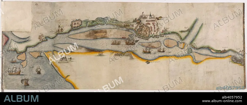
Map representing the course of the river Garonne from Bordeaux to the sea, with the town of Blaye besieged. 1593. Source: Cotton Augustus I.ii.80.
| Teilen |
|---|
 Pinterest Pinterest |
 Twitter Twitter |
 Facebook Facebook |
 Link kopieren Link kopieren |
 Email Email |
|
Zu einem anderen Lightbox hinzufügen |
|
Zu einem anderen Lightbox hinzufügen |


Haben Sie bereits ein Konto? Anmelden
Sie haben kein Konto? Registrieren
Dieses Bild kaufen.
Nutzung auswählen:

Untertitel:
Siehe automatische Übersetzung
Map representing the course of the river Garonne from Bordeaux to the sea, with the town of Blaye besieged. 1593. Source: Cotton Augustus I.ii.80.
Bildnachweis:
Album / British Library
Freigaben (Releases):
Model: Nein - Eigentum: Nein
Rechtefragen?
Rechtefragen?
Bildgröße:
7932 x 2948 px | 66.9 MB
Druckgröße:
67.2 x 25.0 cm | 26.4 x 9.8 in (300 dpi)
Schlüsselwörter:
