alb5531863
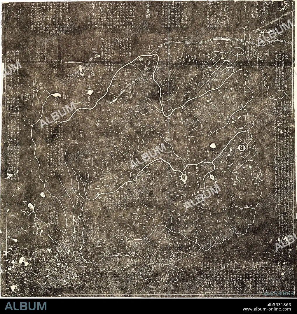
Hua Yi tu, map of China.
| Teilen |
|---|
 Pinterest Pinterest |
 Twitter Twitter |
 Facebook Facebook |
 Link kopieren Link kopieren |
 Email Email |
|
Zu einem anderen Lightbox hinzufügen |
|
Zu einem anderen Lightbox hinzufügen |


Haben Sie bereits ein Konto? Anmelden
Sie haben kein Konto? Registrieren
Dieses Bild kaufen.
Nutzung auswählen:

Titel:
Hua Yi tu, map of China.
Untertitel:
Siehe automatische Übersetzung
Hua Yi tu, map of China. Covers China in Nan Song Dynasty, from east to the sea, including Korea to the west of Pamier area, from north to the Great Wall, northeast to Heilongjiang region, to the south of Hainan Island. Shows mountains, rivers, lakes, and more than 400 administrative place names of China.
Bildnachweis:
Album / Universal Images Group / World History Archive / UIG
Freigaben (Releases):
Model: Nein - Eigentum: Nein
Rechtefragen?
Rechtefragen?
Bildgröße:
4567 x 4592 px | 60.0 MB
Druckgröße:
38.7 x 38.9 cm | 15.2 x 15.3 in (300 dpi)
Schlüsselwörter:
ASIEN • ASIEN, KONTINENT • FLUSS • GEBIRGE • KARTE (KARTHOGRAFIE) • KARTEN • KARTHOGRAPHIE • KONTINENT, ASIEN • LANDKARTE • MASSIV • MEER • MEERE • OZEAN • PLAN (KARTOGRAPHIE) • SEA • SEE • SEESTUECK (GEMAELDE)
