alb3355248
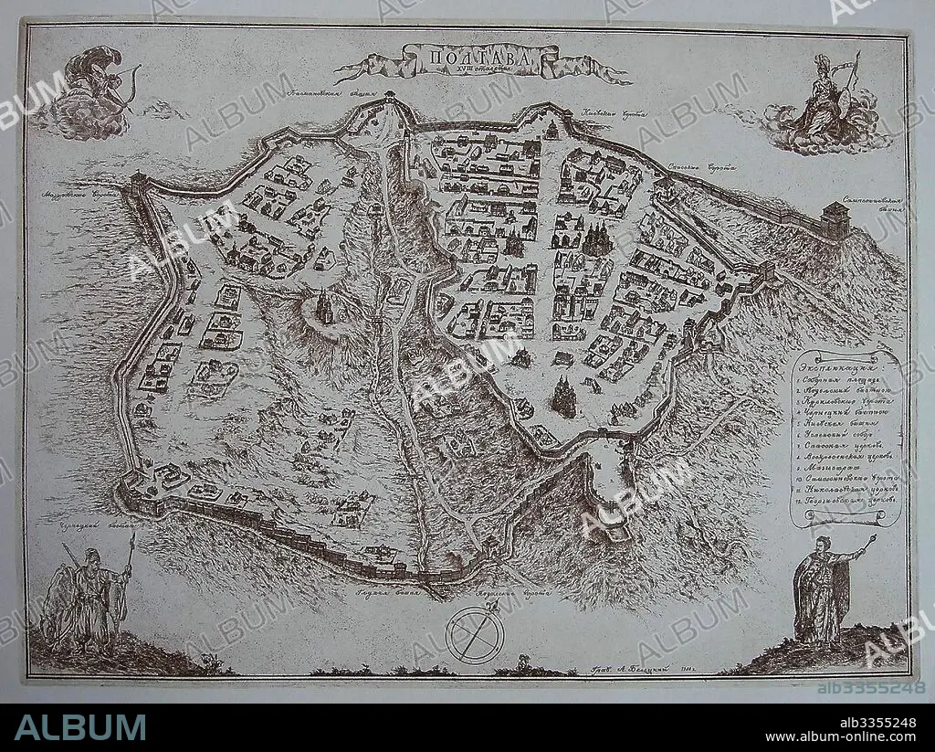
ANONYM. Map of Poltava in the early 18th-century.
| Teilen |
|---|
 Pinterest Pinterest |
 Twitter Twitter |
 Facebook Facebook |
 Link kopieren Link kopieren |
 Email Email |
|
Zu einem anderen Lightbox hinzufügen |
|
Zu einem anderen Lightbox hinzufügen |


Haben Sie bereits ein Konto? Anmelden
Sie haben kein Konto? Registrieren
Dieses Bild kaufen.
Nutzung auswählen:

Autor:
Untertitel:
Siehe automatische Übersetzung
Map of Poltava in the early 18th-century
Technik/Material:
KUPFERSTICH
Museum:
State Open-air Museum "Battle of Poltava", Poltava
Bildnachweis:
Album / Fine Art Images
Freigaben (Releases):
Model: Nein - Eigentum: Nein
Rechtefragen?
Rechtefragen?
Bildgröße:
4399 x 3307 px | 41.6 MB
Druckgröße:
37.2 x 28.0 cm | 14.7 x 11.0 in (300 dpi)
Schlüsselwörter:
