alb9658173
map, Acre, Israel, Third Crusade, Richard I, middle ages, 12th century, historical,
| Teilen |
|---|
 Pinterest Pinterest |
 Twitter Twitter |
 Facebook Facebook |
 Link kopieren Link kopieren |
 Email Email |
|
Zu einem anderen Lightbox hinzufügen |
|
Zu einem anderen Lightbox hinzufügen |


Haben Sie bereits ein Konto? Anmelden
Sie haben kein Konto? Registrieren
Dieses Bild kaufen.
Nutzung auswählen:

Titel: map, Acre, Israel, Third Crusade, Richard I, middle ages, 12th century, historical,
Untertitel: Siehe automatische Übersetzung
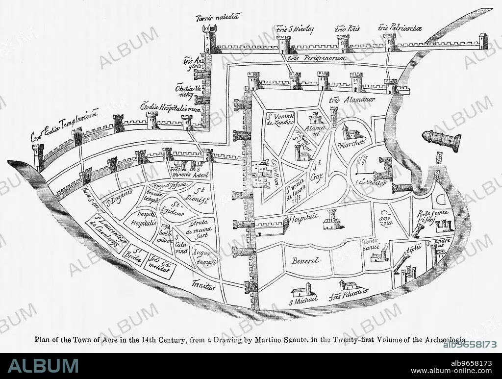
Plan of the Town of Acre in the 14th Century, from a Drawing by Martino Santo in the Twenty-Twenty-First Volume of the Archaeologia, Illustration from John Cassell's Illustrated History of England, Vol. I from the earliest period to the reign of Edward the Fourth, Cassell, Petter and Galpin, 1857
Plan of the Town of Acre in the 14th Century, from a Drawing by Martino Santo in the Twenty-Twenty-First Volume of the Archaeologia, Illustration from John Cassell's Illustrated History of England, Vol. I from the earliest period to the reign of Edward the Fourth, Cassell, Petter and Galpin, 1857
Bildnachweis: Album / Universal Images Group / JT Vintage / Glasshouse Images
Freigaben (Releases): ? Modellfreigabe: Nein - ? Eigentumsfreigabe: Nein
Rechtefragen?
Rechtefragen?
Bildgröße: 5010 × 3522 px | 50.5 MB
Druckgröße: 42.4 × 29.8 cm | 1972.4 × 1386.6 in (300 dpi)
Schlüsselwörter: 12. JAHRHUNDERT • 12. JH. • GEOGRAFIE • GEOGRAPHIE • HORIZONTALE • ILLUSTRATION • ILLUSTRATIONS • ISRAEL • JAHRGANG • KARTE (KARTHOGRAFIE) • KARTEN • KARTHOGRAPHIE • LANDKARTE • PLAN (KARTOGRAPHIE) • RICHARD I. LÖWENHERZ • SCHWARZ UND WEISS • SCHWARZ-WEISS • SCHWARZWEISS
