alb9839453
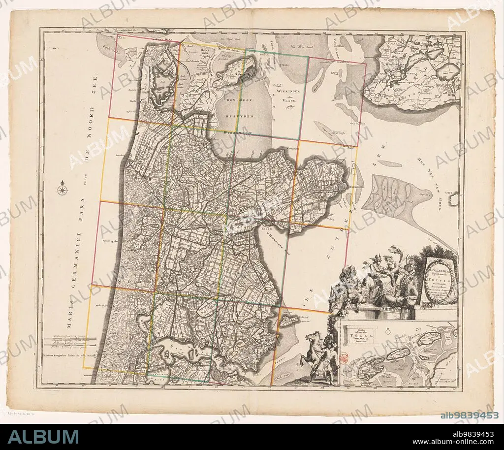
ANON. Map of Noord-Holland and part of Friesland, 1726-1750. Creator: Anon.
| Teilen |
|---|
 Pinterest Pinterest |
 Twitter Twitter |
 Facebook Facebook |
 Link kopieren Link kopieren |
 Email Email |
|
Zu einem anderen Lightbox hinzufügen |
|
Zu einem anderen Lightbox hinzufügen |


Haben Sie bereits ein Konto? Anmelden
Sie haben kein Konto? Registrieren
Dieses Bild kaufen

Autor:
Titel:
Map of Noord-Holland and part of Friesland, 1726-1750. Creator: Anon.
Untertitel:
Siehe automatische Übersetzung
Map of Noord-Holland and part of Friesland, 1726-1750. At the bottom right the title cartouche with figures around it including a man with a horse, satyrs, putti, Mercury who takes the horn of plenty from a female figure, and a river god. Below that a deployment map of the Wadden area with scale.
Bildnachweis:
Album / Heritage Art/Heritage Images
Freigaben (Releases):
Model: Nein - Eigentum: Nein
Rechtefragen?
Rechtefragen?
Bildgröße:
5914 x 4972 px | 84.1 MB
Druckgröße:
50.1 x 42.1 cm | 19.7 x 16.6 in (300 dpi)
Schlüsselwörter:
18. JAHRHUNDERT • 18. JH. • ABDRUCK • ANON • ANONYME • AUSSTELLUNGSGELAENDE • AUSSTELLUNGSGELÄNDE • BILDERGALERIE • BLEISTIFT • BLEISTIFT, FEDER • CHERUB • FARBE • FARBIG • FUELLHORN • FÜLLHORN • GALERIE (KUNST) • GALERIE • GEMAELDEGALERIE • GEMÄLDEGALERIE • ILLUSTRATION • ILLUSTRATIONS • KARTHOGRAFIE • KARTOGRAFIE (KARTE) • KARTOGRAPHIE • KUNSTGALERIE • MANN • MÄNNCHEN • PUTTE • RELIGION • SCHWARZ UND WEISS • SCHWARZ-WEIß • SCHWARZWEISS • STIFT • SZENE • TIER • TIER, ALLE • WISSENSCH.: KARTOGRAPHIE
