alb9508142
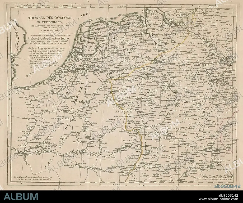
Map of Germany, Holland and Northern France, Tooneel des war in Duitschland (title on object), Map of Germany, Holland and Northern France, with the distance between the cities in hours., print maker: Willem Cornelis van Baarsel, (mentioned on object), publisher: Evert Maaskamp, (mentioned on object), Amsterdam, 1806 - 1813, paper, engraving, height 340 mm × width 426 mm.
| Teilen |
|---|
 Pinterest Pinterest |
 Twitter Twitter |
 Facebook Facebook |
 Link kopieren Link kopieren |
 Email Email |
|
Zu einem anderen Lightbox hinzufügen |
|
Zu einem anderen Lightbox hinzufügen |


Haben Sie bereits ein Konto? Anmelden
Sie haben kein Konto? Registrieren
Dieses Bild kaufen

Untertitel:
Siehe automatische Übersetzung
Map of Germany, Holland and Northern France, Tooneel des war in Duitschland (title on object), Map of Germany, Holland and Northern France, with the distance between the cities in hours., print maker: Willem Cornelis van Baarsel, (mentioned on object), publisher: Evert Maaskamp, (mentioned on object), Amsterdam, 1806 - 1813, paper, engraving, height 340 mm × width 426 mm
Bildnachweis:
Album / quintlox
Freigaben (Releases):
Model: Nein - Eigentum: Nein
Rechtefragen?
Rechtefragen?
Bildgröße:
3764 x 2955 px | 31.8 MB
Druckgröße:
31.9 x 25.0 cm | 12.5 x 9.8 in (300 dpi)
Schlüsselwörter:
AMSTERDAM • DEUTSCHLAND • ENTFERNUNG • GRAVUR • HOLLAND • KARTE (KARTHOGRAFIE) • KARTEN • KARTHOGRAPHIE • LANDKARTE • OBJEKT • PAPIER • PLAN (KARTOGRAPHIE) • STICH (KUNST) • ZEIT
