alb4090241
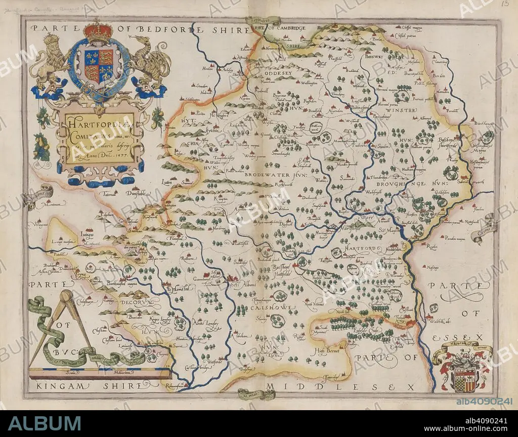
CHRISTOPHER SAXTON. Hertfordshire. Atlas of the Counties of England and Wales. London, 1579. Map of Hertfordshire. Image taken from Atlas of the Counties of England and Wales. Originally published/produced in 1579. Source: Maps.C.3.bb.5, 13.
| Teilen |
|---|
 Pinterest Pinterest |
 Twitter Twitter |
 Facebook Facebook |
 Link kopieren Link kopieren |
 Email Email |
|
Zu einem anderen Lightbox hinzufügen |
|
Zu einem anderen Lightbox hinzufügen |


Haben Sie bereits ein Konto? Anmelden
Sie haben kein Konto? Registrieren
Dieses Bild kaufen

Untertitel:
Siehe automatische Übersetzung
Hertfordshire. Atlas of the Counties of England and Wales. London, 1579. Map of Hertfordshire. Image taken from Atlas of the Counties of England and Wales. Originally published/produced in 1579. Source: Maps.C.3.bb.5, 13.
Bildnachweis:
Album / British Library
Freigaben (Releases):
Model: Nein - Eigentum: Nein
Rechtefragen?
Rechtefragen?
Bildgröße:
10000 x 7913 px | 226.4 MB
Druckgröße:
84.7 x 67.0 cm | 33.3 x 26.4 in (300 dpi)
Schlüsselwörter:
